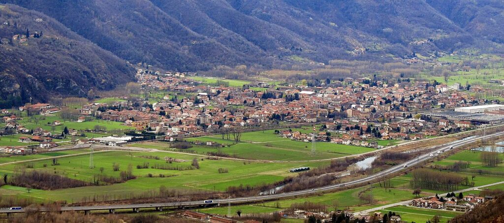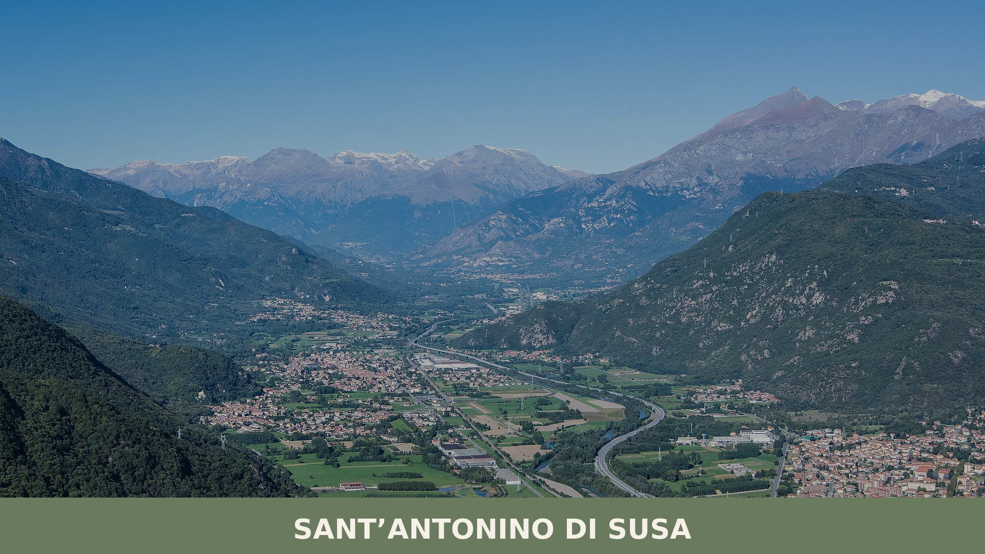
The Dora Riparia cuts through a landscape of grey stone and deciduous woods, and on the right orographic flank of the Dora Riparia, at 380 metres above sea level, Sant’Antonino di Susa rises with the quiet presence of a place that has witnessed centuries without fanfare. Slate roofs and church spires mark the modest skyline; the air carries the memory of water wheels and textile mills alongside the older stillness of pilgrimage roads.
Sant’Antonino di Susa village in Piedmont occupies the lower reaches of the Val di Susa, a territory suspended between the alpine foothills and the industrial past of Piedmont. Visitors arrive to encounter a place of medieval religious foundations, a village whose identity was forged by both the Via Francigena crossing its centre and the dramatic partisanship of World War II.
Medieval Foundations and Wartime Resistance
The earliest permanent settlement in this territory was the borgo of Sant’Agata, established in the early medieval period as the seat of the prevostura of San Desiderio. The village itself took recognizable form when, a church was built in the town centre—a structure that endures today as testimony to ecclesiastical patronage and stone craft.
The twentieth century brought industrial transformation and then rupture. Around 1900, a cotton mill named Wild & Abegg was established on land the municipality offered at reduced cost; the factory later became known as Cotonificio Vallesusa. It drew workers from surrounding villages and anchored the local economy for decades until financial collapse in the late 1960s triggered severe unemployment across the region.
Between 10 and 18 May 1944, the Sangone valley experienced one of the Nazi-fascist occupation’s most brutal operations: Habicht, a vast sweep that burned entire hamlets and resulted in numerous executions.
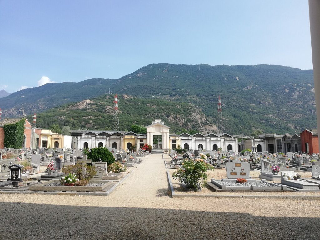
Sant’Antonino’s role in the partisan struggle remains deeply etched in local memory. During the German occupation, Operation Habicht—a massive Nazi-fascist security sweep lasting from 10 to 18 May 1944—devastated the Sangone valley. Entire settlements, particularly Forno and Pontetto, were sacked and burned. Fighters and civilians captured in the woods above Villar Focchiardo were brought to Sant’Antonino and executed, with some buried behind the cemetery perimeter wall. Ten others were deported to Germany. This violence remains visible in the landscape and in the village’s collective identity.
The Medieval Church and Pilgrimage Routes
The Church of Sant’Agostino
Standing in the centre of Sant’Antonino di Susa, the church represents the oldest permanent structure in the village. Commissioned by the nobility of San Giusto di Susa, it anchored religious and community life across the medieval centuries. The building survives as an architectural and spiritual marker, though its original Romanesque character has been modified by later interventions. Today it remains the parish church and a reminder of the ecclesiastical networks that once bound the Val di Susa to wider Christian institutions.
The Via Francigena Passage
Sant’Antonino di Susa lies directly on the historic Via Francigena, the pilgrimage route that connected northern Europe to Rome. This ancient way still traces through the village centre, linking it to Vaie and Sant’Ambrogio di Torino. The presence of this arterial pilgrimage road shaped medieval commerce, cultural exchange and the village’s role as a waypoint—a function that modern pilgrims and heritage walkers continue to recognize today.
Industrial Heritage and Economic Transformation
The Cotonificio Vallesusa stands as the symbolic centre of Sant’Antonino’s modern industrial identity, though the mills themselves are now silent. The cotton industry brought employment, infrastructure and a new rhythm to the village in the early twentieth century. Its collapse in the late 1960s, however, dealt a lasting blow to the local economy and the surrounding communes. The social and cultural traces of that era—worker housing, mill architecture, the memory of extended families tied to factory shifts—remain embedded in the village’s physical and social fabric, marking a significant transition from rural-ecclesiastical to industrial-working-class identity.
Territory and Neighbouring Villages
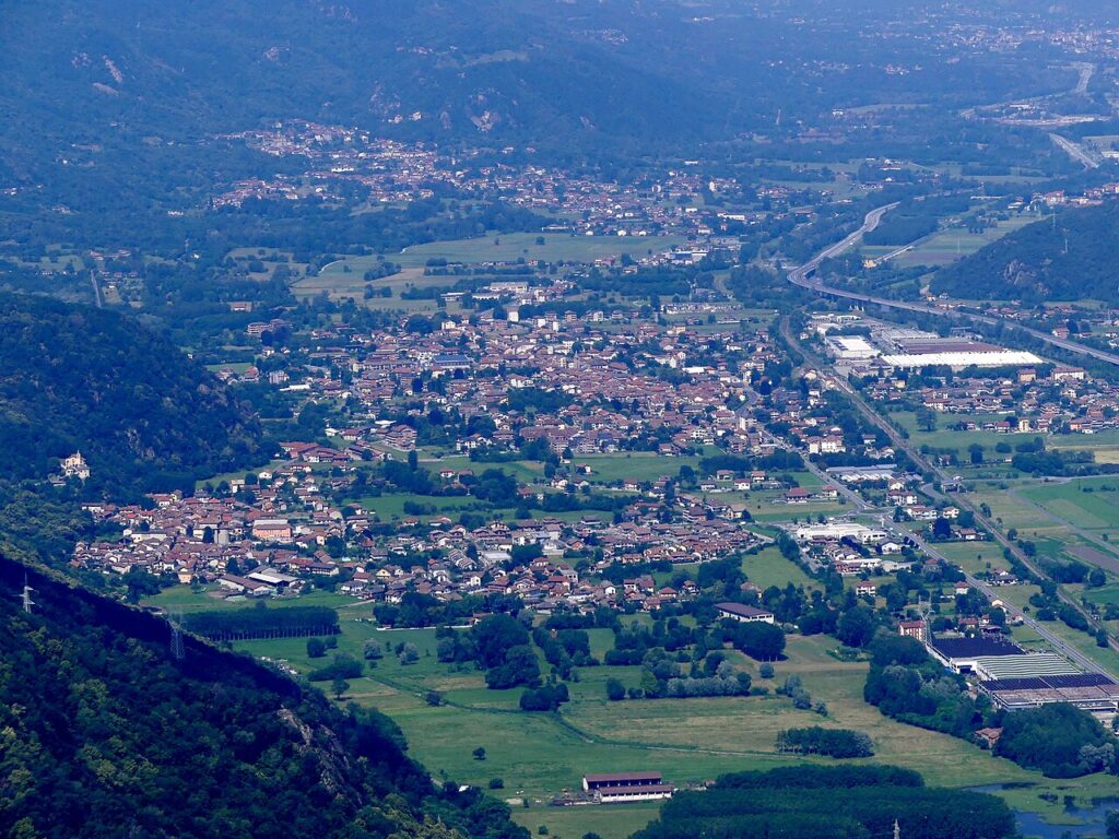
Sant’Antonino di Susa sits within the metropolitan city of Turin, in the region of Piedmont, positioned on the right orographic flank of the Dora Riparia. The lower Val di Susa, where the village stands, opens toward the Piedmontese plain. Nearby municipalities include Vaie, Borgone Susa, Condove, Villar Focchiardo, Chiusa di San Michele, Caprie, San Didero and Valgioie. This network of small towns forms a coherent territorial identity shaped by shared geography, shared history of partisan resistance, and shared industrial heritage. Visitors exploring the valley often move between these communities, each offering distinct historical depth and connection to the broader Susa valley narrative.
Food and Agricultural Tradition
The Piedmont region produces a rich assortment of protected designation products. The province of Turin itself encompasses goods ranging from the Nocciola del Piemonte (hazelnut PGI) and the Marrone della Valle di Susa (chestnut IGP), products intimately connected to the valley where Sant’Antonino sits. The territory’s agricultural output reflects the transition from alpine foothills to piedmont plains, with chestnuts, hazelnuts and dairy products forming the backbone of food culture.
Local and regional tables feature pasta enriched with butter and cheese, polenta-based dishes, and preparations built around seasonal game and freshwater fish. While Sant’Antonino itself does not possess documented signature dishes, its location within this gastronomic landscape connects residents and visitors to the broader Susa valley and Piedmontese food heritage.
Planning Your Visit
Sant’Antonino di Susa is best visited during the warmer months—late spring through early autumn—when the Val di Susa is fully accessible and pilgrimage routes are most active. The village itself is compact and easily walked in a few hours. Spring brings wildflowers to the valley slopes; autumn offers mild temperatures and the colours of deciduous forests. Winter is possible but can be cold and damp at this altitude.
Access from Turin is straightforward. The village lies along the main valley road and rail line connecting Turin to the Alps. If you arrive by car, parking is available in and around the village centre; the narrow lanes of the old town are best explored on foot. The railway station at Sant’Antonino–Vaie provides direct connections to Turin, though schedules are modest. For those following the Via Francigena or the Cammino di San Michele, Sant’Antonino serves as a natural waypoint with accommodation and modest services.
| Departure Point | Distance | Approximate Travel Time |
|---|---|---|
| Turin city centre | 50 km | 50–60 minutes (car) |
| Turin Porta Nuova railway station | 50 km | 60–75 minutes (regional train) |
| Borgone Susa (neighbouring commune) | 5 km | 10 minutes (car) |
| Avigliana (Val di Susa) | 18 km | 25 minutes (car) |
Sant’Antonino di Susa’s patron saint is Sant’Antonino, honoured in local religious tradition and calendar. The village offers basic facilities—bars, small shops, a post office—though for broader services and dining, visitors may venture to larger neighbouring towns. The official municipal website (https://www.comune.santantoninodisusa.to.it/) provides practical information on opening hours, local events and administrative services.