


Colobraro
What to see in Colobraro, Italy: explore the village at 630 m altitude known as ‘that village’. Discover its curse legend, Sinni valley views & local food. Read the guide.
Discover Colobraro
The valley of the river Sinni stretches out below the southern slopes of Mount Calvario, and from a height of 630 m (2,067 ft) a compact settlement of stone houses looks out over the entire Ionian Sea coast. The town borders Valsinni to the north, and the reservoir of Mount Cotugno reservoir fills the middle distance on clear days.
Its name, locals in neighbouring towns refuse to speak aloud, replacing it in dialect with chillu paese, meaning simply “that village.” The chandelier story is still told in courthouses well beyond this province.
Deciding what to see in Colobraro means engaging directly with one of southern Italy’s most documented folk reputations, a place where geography, etymology, and oral tradition converge in a single hilltop comune.
Positioned at 630 m (2,067 ft) in the province of Matera, Colobraro, Basilicata, Italy offers visitors the valley panorama of the Sinni River, the atmospheric streets of a compact historic centre, and the direct experience of a place that neighbouring communities have refused to name for generations. The Colobraro highlights include its elevated position on Mount Calvario, its proximity to the Sinni River dam, and its layered history rooted in Latin etymology and southern Italian folk belief.
History of Colobraro
The name Colobraro derives directly from the Latin word coluber, meaning serpent.
In the cultural framework of southern Italy, the serpent carried strong associations with evil and malevolent forces, and the etymology gave the town a stigma that attached itself early and has not loosened since. Neighbouring communities across the province of Matera developed the habit of avoiding the name entirely, substituting it in local dialects with chillu paese in one variant, cudd’ puaise in another, and chill’ pais in a third — all translating as “that village.” This linguistic avoidance is not a modern affectation; it reflects a long-standing regional practice of deflecting what speakers considered an inherently unlucky word.
The most frequently cited origin of the town’s association with misfortune involves a lawyer who travelled to Colobraro to argue a case in the local courthouse.
During proceedings, he declared that if he failed to win, the chandelier above him should fall. The chandelier fell and shattered at that precise moment. The story circulated and solidified into local fact. Through the 1950s, accounts multiplied involving masciare — women reputed across southern Italy to possess the ability to cast spells and practice black magic — who were said to operate in and around Colobraro.
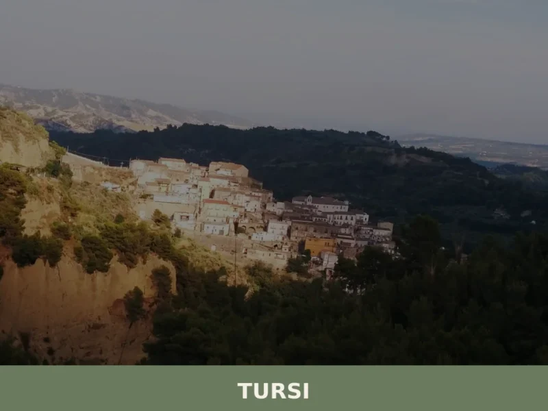
These accounts reinforced the town’s standing as a place of concentrated ill fortune, and the label “the village without a name” became its most persistent identifier. The nearby town of Tursi, which shares the same section of the Sinni valley, developed its own distinct identity precisely in contrast to this neighbouring reputation.
The comune sits within the province of Matera, approximately 80 km (49.7 mi) from the provincial capital of Matera and approximately 130 km (80.8 mi) from Potenza, the regional capital of Basilicata. Administratively, Colobraro borders Valsinni, Tursi, Rotondella, Senise, Sant’Arcangelo, and Noepoli. Its position near Highway 653 and the dam built on the Sinni River at Mount Cotugno places it within a network of small agricultural communities that have historically depended on the valley’s resources.
The town functions as one of several agricultural centres in the Sinni River valley, a role that has defined its economy across multiple centuries of recorded settlement.
What to see in Colobraro, Basilicata: top attractions
The Historic Centre and Its Streets
The stone fabric of Colobraro’s historic centre follows the natural topography of Mount Calvario’s southern slopes, with narrow lanes that respond to the gradient rather than any imposed grid.
The elevation of 630 m (2,067 ft) means that almost every street delivers a sightline toward the Sinni valley below. Walking through the centre, visitors encounter the tight spatial logic of a hilltop settlement that developed in response to terrain and defence rather than commerce or ceremony. The best approach is on foot from the lower parking areas, moving upward through the layers of the old town. Late afternoon, when the light strikes the stone facades at a low angle, gives the clearest reading of the building fabric.
The View from Mount Calvario
From the upper reaches of Mount Calvario, the full extent of the Ionian Sea coastline becomes visible on days without significant haze.
The elevation gain from the valley floor to the summit area covers several hundred metres, and the panorama encompasses the Sinni River’s course as it moves toward the sea. This is the geographic logic that explains Colobraro’s position: a settlement placed high enough to monitor the valley and the approaches from the coast. The view also takes in the reservoir created by the dam on the Sinni River at Mount Cotugno, a large body of water visible to the south.
Mornings tend to offer the clearest atmospheric conditions for this panorama.
The Sinni River Valley and the Mount Cotugno Dam
The dam constructed on the Sinni River at Mount Cotugno created one of the largest artificial reservoirs in southern Italy, and from Colobraro’s position the scale of the intervention in the landscape is immediately legible.
The reservoir now defines the middle distance in views toward the south and southeast, altering the valley profile that earlier inhabitants of the town would have known. Highway 653, which runs close to Colobraro, connects the valley settlements and provides the most direct road access to the dam area. The proximity to this infrastructure makes Colobraro a practical stopping point for visitors exploring the Sinni valley system. The relationship between the hilltop town and the engineered valley below it is one of the defining contrasts of the area.
The Folklore Landscape: Sites Associated with the Curse Legend
The reputation Colobraro carries is inseparable from specific physical spaces: the courthouse where the chandelier incident occurred, the streets where masciare were said to operate in the 1950s, and the visible topography of a settlement that outsiders historically approached with reluctance. What to see in Colobraro includes engaging with this geography of superstition — the spaces are real even if the events attributed to them belong to oral tradition.
The local dialect terms chillu paese and cudd’ puaise remain in active use among older speakers in neighbouring towns.
Visitors who arrive during the town’s organised events related to its curse mythology will find these spaces animated and contextualised by local guides.
The Surrounding Agricultural Landscape
Colobraro operates as one of the agricultural centres of the Sinni River valley, and the cultivated terraces and field systems visible from the town’s edges reflect a land-use pattern maintained across multiple generations. The southern slopes of Mount Calvario carry the evidence of this agricultural continuity in their terraced profiles. The borders of the comune touch Valsinni, Rotondella, Senise, Sant’Arcangelo, and Noepoli, and the road network connecting these communities passes through farmland that transitions between valley-floor irrigated fields and hillside dry cultivation.
For visitors exploring the area by car, the 80 km (49.7 mi) route from Matera to Colobraro passes through a sequence of comparable landscapes before the final ascent to the town.
Local food and typical products of Colobraro
The cuisine of the Sinni River valley belongs to the broader culinary tradition of Basilicata, a region whose food culture developed under conditions of agricultural self-sufficiency and geographic isolation from major trade routes. The valley’s access to both upland pasture and irrigated lowland fields created a diet that combined cereal-based preparations, preserved meats, and seasonal vegetables in proportions that varied by altitude and season. Colobraro, at 630 m (2,067 ft), sits at a transitional elevation where the cooking reflects both the pastoral traditions of higher ground and the legume and grain cultivation of the valley floor.
Pasta preparations typical of Basilicata appear on tables in and around Colobraro in forms shaped by hand rather than machine.
Cavatelli, short hollow pasta rolled against a wooden board to produce a curl that holds sauce in its interior, is made with durum wheat semolina and water, without egg. It is typically served with a ragù of local pork or lamb, or with a sauce of dried peperoni cruschi — the thin-skinned sweet red peppers of Basilicata, dried and then fried briefly in olive oil until they become translucent and crisp.
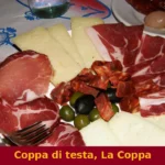
Lagane e ceci, wide flat pasta strips cooked directly with chickpeas in a broth seasoned with garlic and local olive oil, represents one of the oldest documented preparations in the region, with Roman-era references to the dish placing it in continuous use across two millennia. Preserved meats, including soppressata — a coarse-ground pork salume pressed into a flattened form and cured with black pepper and dried chilli — appear as antipasto or as a flavouring in cooked preparations.
The certified product landscape of Basilicata includes several designations relevant to the broader Sinni valley area. While Colobraro itself does not hold individual certified product designations documented in the available sources, the regional framework places it within production zones for Basilicata’s olive oil and cereal products. The peperone crusco of Senise, a neighbouring comune with which Colobraro shares agricultural geography, carries IGP (Indicazione Geografica Protetta) status and is produced across the Sinni valley municipalities.
Visitors to the area will encounter it in markets and local shops as both a dried product and a processed ingredient.
Local food purchasing opportunities in the Sinni valley tend to concentrate around the summer months, when agricultural production peaks and local markets operate with greater frequency.
The town of , situated nearby in the same valley system, shares many of the same food traditions and provides additional access to valley-produced goods. Visitors planning a food-focused itinerary should note that smaller shops in Colobraro and surrounding comuni may operate on restricted hours outside the summer season, and carrying cash in Euros is advisable as card payment infrastructure in the smaller establishments is not guaranteed.
Festivals, events and traditions of Colobraro
Colobraro has formalised its curse mythology into a recurring performance event known as Che il diavolo vi porti tutti — “May the devil take you all” — a theatrical and folkloric event staged in the streets of the historic centre during the summer months. The event draws on the accumulated stories of masciare, the chandelier legend, and the dialect tradition of refusing to name the town, staging them as live performance across multiple locations within the old town.
This transforms the physical spaces of the historic centre into an outdoor theatrical venue, with actors, guided routes, and atmospheric staging that makes direct use of the town’s narrow streets and elevated positions.
The broader calendar of religious and civic celebration in Colobraro follows the pattern common to Basilicata’s small comuni, with the patron saint’s festival providing the central annual gathering.
The precise date of the patron saint’s celebration is tied to the liturgical calendar, and the associated processions move through the historic centre in the manner documented across the region’s religious life. The summer concentration of events — both the theatrical curse festival and the religious calendar — makes July and August the most active period in the town’s annual cycle, though this coincides with the hottest and most crowded weeks of the Italian summer travel season.
When to visit Colobraro, Italy and how to get there
The best time to visit Colobraro depends on what a visitor prioritises. Spring, between April and June, offers moderate temperatures at 630 m (2,067 ft), reduced crowds compared to the summer peak, and the agricultural landscape at its most productive. The summer months of July and August concentrate the town’s events calendar, including the theatrical curse festival, but also bring the highest temperatures and the heaviest visitor numbers across Basilicata as a whole. September and October provide a practical middle ground: post-summer temperatures, the grape and olive harvest period across the valley, and significantly fewer visitors.
Winter visits are feasible for those travelling independently by car but offer fewer open services in the smaller establishments.
Getting to Colobraro requires a car for most visitors. The town sits near Highway 653, which connects the Sinni valley communities and provides the most direct road access from both Matera and the Ionian coast. From Matera, the drive covers approximately 80 km (49.7 mi) and takes roughly one hour depending on the route.
From Potenza, the regional capital, the distance is approximately 130 km (80.8 mi). If you arrive by car from the north, the route via Senise on Highway 653 is the most straightforward approach. The nearest major rail hub is Potenza Centrale, served by Trenitalia connections from Naples and other cities; from Potenza, onward travel to Colobraro requires a hire car or taxi, as no direct rail or regular bus service reaches the town.
International visitors flying into southern Italy will find the airports of Bari (approximately 170 km / 105.6 mi to the north) and Naples (approximately 280 km / 174 mi to the northwest) as the most practical entry points, both requiring a hire car for the final leg. A day trip from the nearest major city is feasible from Matera, which itself is well-connected to Bari by rail and road. English is spoken only occasionally in smaller shops and restaurants in Colobraro; carrying Euros in cash is recommended.
Visitors extending their time in the area can reach Potenza, the regional capital some 130 km (80.8 mi) to the northwest, for a broader base from which to explore southern Basilicata. The drive between the two follows a route that crosses the internal highlands of the region, passing through landscapes that shift from valley agriculture to upland scrub. Those approaching from Basilicata’s northern municipalities might also consider the route through Calvera, a small comune in the Sinni valley system that shares the same geographic and cultural zone as Colobraro.
🚶 Religious routes in Basilicata
- Via Francigena · 1970 km
- Cammino Basiliano · 1535 km
- Cammino Materano – Sei vie di fede nel Sud Italia · 430 km
- Percorso antico della fede Madonna del Pollino · 186 km
- Cammino della Madonna Nera · 52 km
Source: Italian Ministry of Tourism, open data 2024
Frequently asked questions about Colobraro
What is the best time to visit Colobraro?
Spring and early summer offer the clearest atmospheric conditions for panoramic views over the Sinni valley and the Ionian coast. The feast of the patron saint San Nicola falls on 9 May, making late April to mid-May the most festive period to visit. Autumn brings mild temperatures and harvest activity across the surrounding agricultural landscape. Summer mornings are best for the panorama from Mount Calvario before haze builds over the valley. Winter access via Highway 653 is straightforward but the hilltop site at 630 m can be cold and windy.
What are the historical origins of Colobraro?
Colobraro takes its name directly from the Latin word coluber, meaning serpent, an etymology that attached a stigma of ill omen to the settlement from an early date. Neighbouring communities across the province of Matera responded by refusing to speak the name aloud, substituting dialect phrases meaning 'that village'. The town's reputation was amplified by a widely circulated courthouse story — a lawyer declared that if he lost his case the chandelier should fall, and it did — and by 1950s accounts of masciare, women reputed to practise spells and black magic, said to operate in and around the comune.
What to see in Colobraro? Main monuments and landmarks
The compact historic centre climbing the southern slopes of Mount Calvario is the primary attraction, best explored on foot from the lower parking areas moving upward through the old stone lanes. From the upper reaches of Mount Calvario the full Ionian coastline becomes visible on clear days, along with the vast Mount Cotugno reservoir on the Sinni River. The physical spaces associated with the curse legend — including the courthouse linked to the chandelier incident — form an identifiable folklore landscape that local guides contextualise during the town's organised events.
What are the main natural or scenic attractions of Colobraro?
The Sinni River valley stretching below the town and the panorama toward the Ionian Sea coast are the defining natural features. The Mount Cotugno dam on the Sinni River created one of the largest artificial reservoirs in southern Italy, clearly visible from Colobraro's elevated position. The terraced agricultural slopes of Mount Calvario document generations of hillside cultivation. The surrounding comune boundaries touch Valsinni, Rotondella, Senise, Sant'Arcangelo, and Noepoli, and the road network through this landscape rewards exploration by car.
Where to take the best photos in Colobraro?
The upper area of Mount Calvario provides the widest panorama, taking in the Sinni River course, the Mount Cotugno reservoir, and on clear days the Ionian Sea coastline. Morning light offers the sharpest atmospheric conditions for distance shots. Late afternoon is the recommended time for photographing the historic centre itself, when low-angle light strikes the stone facades of the old town lanes. Views from the edges of the settlement looking south and southeast frame the engineered reservoir against the natural valley profile.
What can you do in Colobraro? Activities and experiences
Walking the historic centre on foot is the core activity, with the ascent from lower parking areas through the old lanes taking visitors past the key sites of the folklore landscape. During organised events tied to the curse legend, local guides lead contextualised visits through the relevant spaces including the courthouse. The town's position near Highway 653 makes it a natural stopping point for a broader Sinni valley itinerary that can include the Mount Cotugno dam area and the neighbouring comuni of Valsinni and Tursi. The feast of San Nicola on 9 May offers a traditional religious and community event.
Who is Colobraro suitable for?
Colobraro suits travellers with a specific interest in southern Italian folk culture, mythology, and oral tradition, since the curse legend and the 'village without a name' identity are its most distinctive qualities. The compact historic centre and the panoramic position appeal to those exploring the hilltop villages of the Basilicata interior. The Sinni valley setting attracts visitors following an itinerary through the province of Matera. Families, couples, and solo travellers comfortable with small-scale, quiet destinations will find it rewarding, particularly when timed around the San Nicola feast on 9 May or organised folklore events.
What to eat in Colobraro? Local products and specialties
The cooking reflects the broader Basilicata tradition: cavatelli — hand-rolled durum wheat pasta served with local pork or lamb ragù or with peperoni cruschi — and lagane e ceci, wide flat pasta strips cooked with chickpeas in garlic-seasoned olive oil, a preparation with documented Roman-era origins. Soppressata, a coarse-ground pork salume pressed flat and cured with black pepper and dried chilli, appears as antipasto or as a cooking ingredient. The peperone crusco of nearby Senise, thin-skinned sweet red peppers dried and fried briefly in olive oil until crisp, is the signature product of this section of the Sinni valley.
📷 Photo Gallery — Colobraro
Getting there
Via Maria Santissima d'Anglona, 75021 Colobraro (MT)
Nearby Villages near Colobraro
In Basilicata More villages to discover

Craco
What to see in Craco, Italy: explore the abandoned town at 400 m (1,312 ft), its medieval tower, film locations, and Basilicata's landscape. Discover it all here.
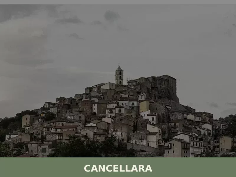
Cancellara
What to see in Cancellara: Discover Italy's Basilicata region, a village at 680 m (2,231 ft) known for its medieval castle and ancient necropolis. Explore its history and salami festival.
Calciano
Six hundred inhabitants, a dialect that calls the town Caucësciànë, and a landscape that the province of Matera renders with geometric precision: clay hills that change colour with the passing hours, narrow streets where the wind carries dust in summer and silence in winter. In this article History and origins of Calciano What to See […]

Cirigliano
What to see in Cirigliano, Italy: a medieval village with a 17th-century Pietu00e0, an oval castle tower, and local pasta traditions. Discover 5 top attractions.
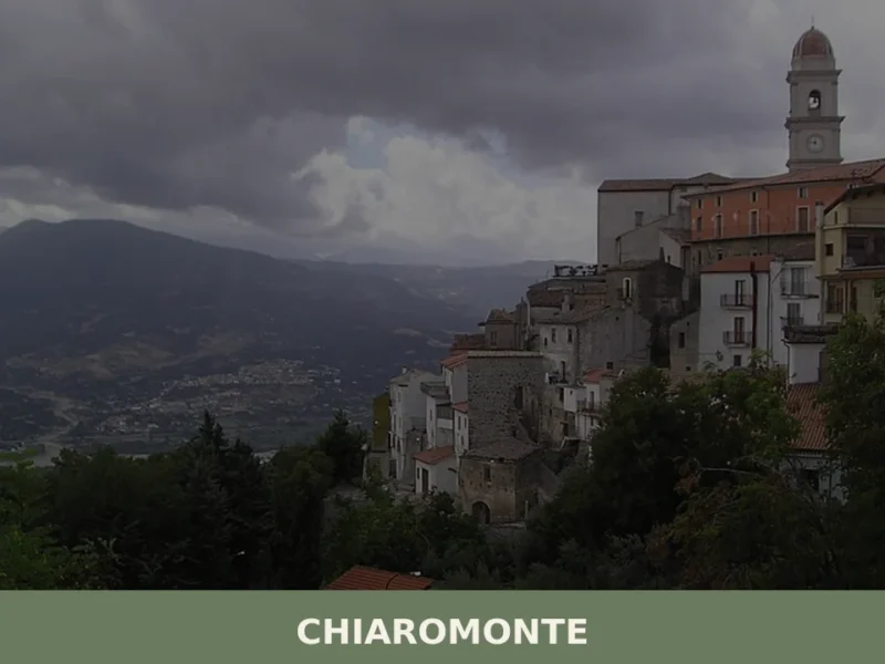
Chiaromonte
what to see in chiaromonte, Italy: Discover its 794m altitude and delve into its history, from ancient roots to the case study of Montegrano. Explore Basilicata.

Castelluccio Inferiore
What to see in Castelluccio Inferiore: 5 must-see attractions, from the historic center to baroque churches. Discover the complete guide to this Basilicata village.
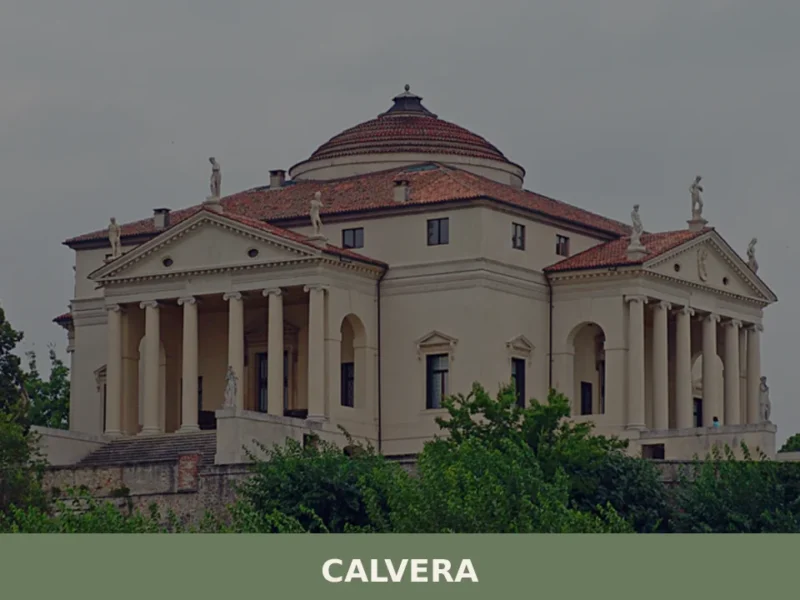
Calvera
At 630 meters above sea level, in the heart of the province of Potenza, lies Calvera, a small Lucanian municipality distinguished by its elevated position and authentic atmosphere. The village, with its stone houses clinging to the hillside, offers panoramic views of the surrounding valley, bearing witness to a history of mountain life and a […]

Ferrandina
What to see in Ferrandina, Basilicata, Italy: 6 historic churches, olive oil production, and a hilltop at 482 m. Discover top attractions and how to get there.
🧀 Italian traditional products


🏡 Know Colobraro better than we do?
If you’re a local or have been there, your knowledge matters: add what’s missing or fix a detail on this page.