


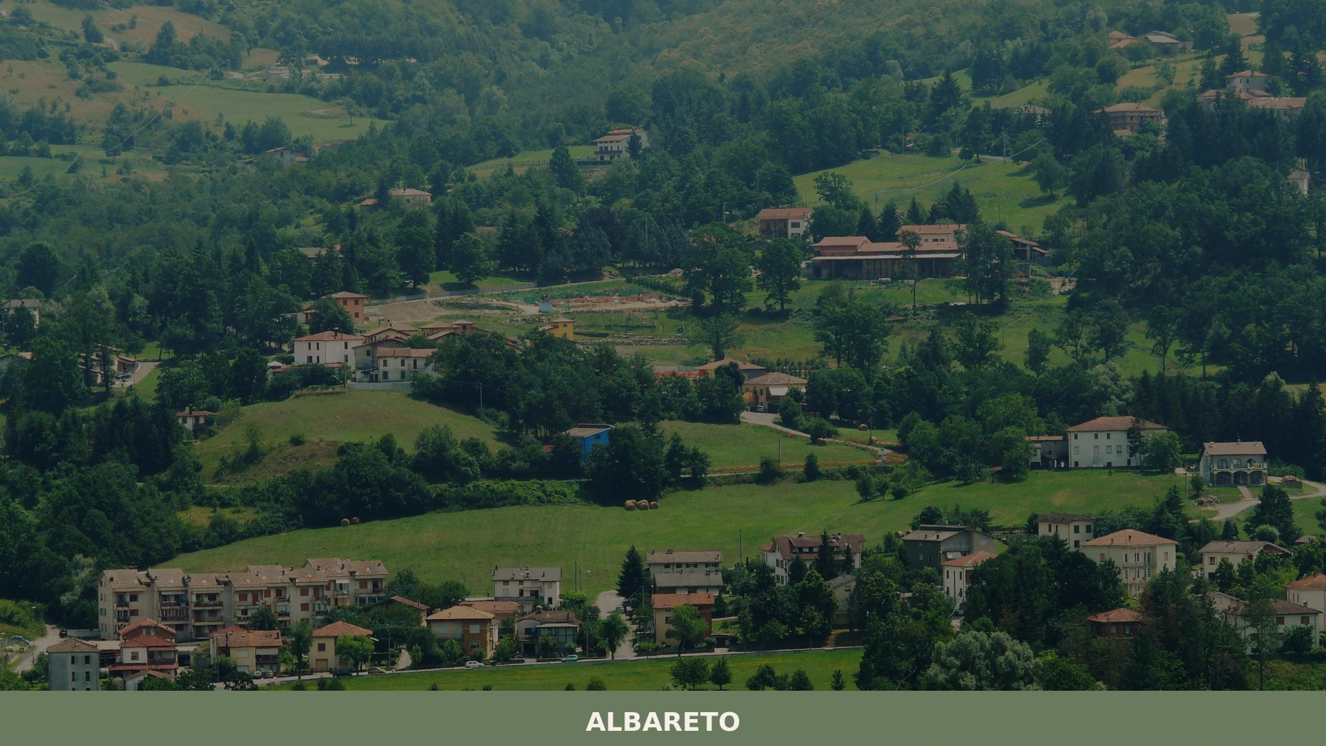
Albareto
What to see in Albareto? Explore 5 must-see attractions and the most charming spots in this Emilia-Romagna village. Plan your visit!
Discover Albareto
The Val Taro narrows here, where the Ligurian Apennines press close on both sides and the forest holds its ground against the fields.
Borgo Val di Taro lies a short distance downstream, but Albareto occupies its own ridge-level position, where the air carries resin from chestnut and fir and the road climbs sharply before flattening into the village square.
Seven municipalities share a border with this commune, and on clear days the watershed between Emilia-Romagna and Liguria is visible as a dark line of crest above the treeline.
Knowing what to see in Albareto means understanding its position in one of the least-trafficked valleys of the Province of Parma, roughly 130 km (81 mi) west of Bologna and 60 km (37 mi) southwest of Parma.
Visitors to Albareto find a mountain comune set within a ring of neighbouring municipalities — Borgo Val di Taro, Compiano, Tornolo, and the Ligurian communes of Varese Ligure and Sesta Godano — that together define the character of this high Apennine border zone.
The main draws include the surrounding forested ridges, the valley landscape shaped by the Taro river system, and a food culture rooted in mountain agriculture and cross-border exchange with Liguria.
History of Albareto
The name Albareto derives from the Latin albaretus, a term referring to a grove of white poplars or other light-barked trees, which points to the vegetation that once characterised the valley floor near the settlement.
In the local Parmigiano dialect, the village is still called Albarèjj, preserving a phonetic form that predates standardised Italian.
Place names of this type are common across the Apennine arc between Emilia-Romagna and Liguria, where Latin root words survived through medieval usage in deeds and ecclesiastical records tied to the management of woodland and river land.
Throughout the medieval period, the upper Val Taro formed a contested zone between the ecclesiastical and feudal powers based in Parma and the maritime Republic of Genoa, whose commercial interests extended deep into the Apennine passes.
Control over routes crossing these mountains had direct economic consequences, as salt, dried fish, and cloth moved northward from the Ligurian coast while grain and livestock moved south.
Albareto, positioned close to the watershed, fell within the sphere of influence of local noble families whose fortunes depended on taxing or protecting these flows. The nearby commune of Corte Brugnatella, further north along the Trebbia valley system, experienced a comparable pattern of feudal lordship and cross-Apennine commerce during the same period.
By the early modern period, Albareto had consolidated as a recognised administrative unit within the Duchy of Parma, the political entity that governed much of the province from the sixteenth century onward.
The Farnese and later Bourbon rulers of Parma extended their administrative reach into mountain communities through parish records and land registries, traces of which survive in provincial archives.
The unification of Italy in the nineteenth century integrated Albareto into the Kingdom of Italy and subsequently into the republican administrative system, under which it became a comune — the basic municipal unit of Italian local government — within the Province of Parma, a status it retains today.
What to see in Albareto, Emilia-Romagna: top attractions
The Ligurian-Emilian Apennine landscape and the Val Taro
The terrain immediately surrounding Albareto rises from the Taro valley floor to forested ridges that mark the administrative boundary between Emilia-Romagna and Liguria, with elevations in the broader municipal area reaching well above 1,000 m (3,281 ft).
The Taro river, which has its headwaters in these mountains, has cut the valley into a sequence of narrow gorges and wider pastoral basins visible from the roads climbing out of the village. Standing at the upper edge of the built area, a visitor looks across a landscape where active grazing land and dense mixed woodland alternate on opposing slopes.
The clearest views come in late autumn after leaf fall, when the ridgeline above Varese Ligure is fully exposed to the east.
The municipal boundaries and the seven-comune border zone
Few villages in the Province of Parma share borders with as many as seven distinct municipalities, and the border zone around Albareto is one of the more geographically complex in the province.
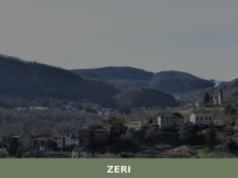
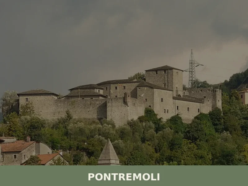
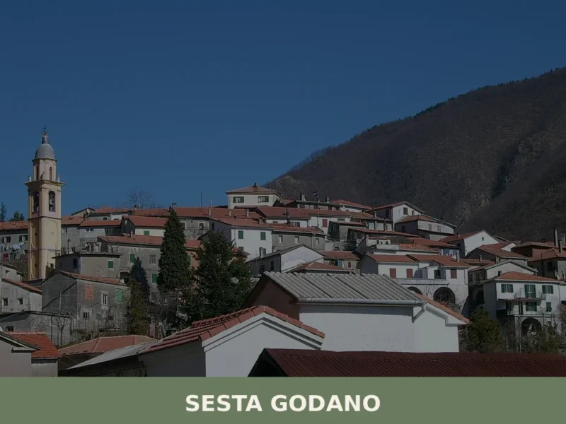
The communes of Borgo Val di Taro, Compiano, Pontremoli, Sesta Godano, Tornolo, Varese Ligure, and Zeri all meet Albareto’s territory, creating a point where three administrative regions effectively converge.
Walking or driving the roads that trace these boundaries reveals abrupt changes in road surface, signage language, and agricultural practice — Ligurian olive cultivation gives way within a few kilometres to the chestnut orchards and hay meadows typical of the Parma uplands.
This border character has shaped the village’s economy and dialect for at least five centuries.
The village centre and its parish church
The compact built fabric of Albareto follows the ridge contour, with the parish church occupying a central position relative to the residential streets. Stone construction predominates, using local Apennine sandstone cut in irregular courses that weather to a dark grey-brown over time.
The church interior follows the pattern of rural Emilian parishes, with a single nave, lateral altars, and votive offerings accumulated over multiple generations of mountain communities whose livelihoods depended on seasonal migration and pastoral farming.
The building fabric visible today reflects interventions across several centuries, though the structural core predates the modern road network that now connects the village to Borgo Val di Taro, approximately 10 km (6.2 mi) to the north.
Chestnut forests and the seasonal woodland economy
The chestnut forests on the slopes above Albareto are not simply landscape features — they represent a documented agricultural system that sustained the population of the upper Val Taro for centuries before commercial food distribution made grain imports economically viable.
Dried and milled chestnuts provided flour for polenta di castagne, a dense paste cooked over open hearths, and whole nuts were stored through winter as a caloric staple.
The trees themselves, some with trunk circumferences exceeding 3 m (9.8 ft), are evidence of deliberate cultivation and coppicing practices going back at least to the medieval period.
Autumn, from October through November, is the season when the forest floor accumulates fallen chestnuts and the harvest activity is most visible to visitors passing through.
The cross-Apennine road network and historic passes
Albareto sits within a network of mountain passes that historically connected the Po plain with the Ligurian coast, and several of these routes remain navigable by car or on foot today. The passes in this section of the Apennines typically reach between 900 m (2,953 ft) and 1,200 m (3,937 ft), making them accessible for most of the year except during heavy snowfall between December and February.
The road descending from the ridge toward Varese Ligure covers roughly 20 km (12.4 mi) and drops more than 600 m (1,969 ft) in elevation, offering a direct experience of the geographical transition from the Padane watershed to the Ligurian one.
For those planning a longer route, Castell’Arquato in the Province of Piacenza provides a complementary stop in a different Emilian valley on the return journey toward the Po plain.
Local food and typical products of Albareto
The food culture of Albareto reflects the village’s position at the intersection of two distinct culinary traditions: the butter, pork, and egg-based cooking of lowland Emilia-Romagna to the north, and the olive oil, dried fish, and herb-forward cooking of Liguria to the south and west.
Mountain altitude and the constraints of a subsistence economy shaped a third strand — a high-Apennine tradition of preservation, drying, and transformation that treated food primarily as fuel for physically demanding seasonal labour.
These three influences did not merge uniformly; they coexist in the local kitchen in proportions that shift depending on the dish, the season, and the family.
Among the most documented preparations of the upper Val Taro, testaroli occupy a significant place — a flat, unleavened pancake cooked on a terracotta or iron disc called a testo, then cut into triangles and dressed with pesto or a simple sauce of oil and local cheese.
The dish crosses the Apennine divide and is also claimed by communities on the Ligurian side of the watershed, reflecting the shared food history of border zones.
Polenta di castagne, made from dried and stone-milled chestnut flour, has a denser, slightly bitter profile compared to maize polenta and was historically served with soft local cheese or preserved meats.
Funghi porcini — Boletus edulis mushrooms harvested from the surrounding forests between July and October — appear in pasta sauces, risottos, and as a dried ingredient traded across the whole province.
The broader Val Taro area is the production zone for Fungo di Borgotaro IGP, a protected geographical indication covering the porcini mushrooms harvested in the forests around Borgo Val di Taro and its neighbouring municipalities.
The IGP designation recognises the specific organoleptic qualities — firm texture, low moisture content, pronounced aroma — produced by the combination of altitude, soil composition, and forest type characteristic of this section of the Ligurian Apennines.
Albareto falls within the broader geographical area associated with this production tradition, and the mushrooms sold at local markets during the autumn season carry the reputation attached to the IGP zone even when sold informally by individual collectors.
Local markets and seasonal fairs in the upper Val Taro concentrate in September and October, when the mushroom harvest is at its peak and chestnut collection begins.
Borgo Val di Taro hosts the Fiera del Fungo, a dedicated mushroom fair that draws buyers and producers from across the province, and Albareto’s proximity — approximately 10 km (6.2 mi) by road — means that visitors using the village as a base can attend the fair and return the same day.
For those purchasing dried porcini or chestnut flour to take home, small local producers and cooperative shops in the valley are the most direct source, and cash payment remains the norm at market stalls.
Festivals, events and traditions of Albareto
The religious calendar in Albareto follows the pattern common to rural Emilian mountain parishes, with the feast of the patron saint serving as the principal annual gathering. Specific dates and the identity of the patron saint are documented in the parish records held at the local church and in the diocesan archive of Parma. These feast days typically combine a morning Mass with a public procession through the village streets, followed by a communal meal and, in the evening, music and sometimes fireworks.
The timing of such celebrations in the upper Val Taro generally falls between late spring and early autumn, avoiding the months when mountain weather makes outdoor gatherings unreliable.
Beyond the religious calendar, the autumn harvest season generates informal communal activity centred on chestnut collection and mushroom picking, practices that bring extended families together on the forested slopes above the village.
The sagra, a traditional local food fair tied to a specific seasonal product, is a format common across Emilia-Romagna, and several neighbouring communes in the Val Taro organise such events in September and October.
Albareto’s small population — the commune is among the smaller municipalities in the Province of Parma — means that village-level events have an informal character, with participation from the permanent residents supplemented by people who maintain family connections to the area despite living elsewhere in the province or region.
When to visit Albareto, Italy and how to get there
The most practical period to visit Albareto is between late May and early October, when mountain roads are fully clear of snow, daylight hours are long, and the surrounding landscape is in active use for farming, forestry, and outdoor activity.
September stands out as particularly well-suited: the mushroom and chestnut seasons are beginning, temperatures at altitude are comfortable for walking — typically between 12°C (54°F) and 22°C (72°F) at mid-day — and the valley roads carry less traffic than in August.
Winter visits are possible for those specifically interested in snowfall conditions, but several secondary roads near the Ligurian border can become impassable without winter tyres between December and February.
This timing consideration applies equally to any day trip from Parma or from the Ligurian coast, since the pass roads are the critical variable.
Reaching Albareto by car from Parma takes approximately one hour via the A15 motorway, exiting at Borgotaro and then following the SS523 southward for roughly 10 km (6.2 mi).
From Bologna, the drive covers approximately 130 km (81 mi) and takes around one hour and forty minutes via the A1 and A15, making it a viable day trip from either city.
The nearest rail connection is at Borgo Val di Taro, served by Trenitalia on the Parma–La Spezia line; from the station, Albareto is reachable by local bus or taxi.
The nearest international airports are Parma Airport (Aeroporto di Parma) at approximately 70 km (43.5 mi) and Genoa Cristoforo Colombo Airport at approximately 90 km (56 mi), with the latter offering more frequent connections to European destinations. International visitors should be aware that English is not widely spoken in smaller shops and services in the upper Val Taro, and carrying Euro cash is advisable for market purchases and rural accommodations.
For those building a broader Emilian itinerary, Albareto pairs naturally with other valley villages in the province.
The Agazzano commune in the Province of Piacenza, set in the Tidone valley to the northwest, offers a different cross-section of Emilian upland landscape and is reachable within two hours by car, making it suitable as a two-day circuit for visitors already in the region.
Those travelling from the Romagna side of the region might also consider Castel del Rio in the Province of Bologna, which sits along the Santerno valley and represents the eastern flank of the same Apennine chain that defines Albareto’s western horizon.
📷 Photo Gallery — Albareto
Nearby Villages near Albareto
In Emilia-Romagna More villages to discover
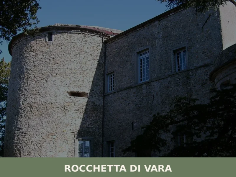
Besenzone
What to see in Besenzone, Italy: Discover a tranquil village of 916 inhabitants at 48 m (157 ft) altitude. Explore its historical sites and local traditions. Read our guide.
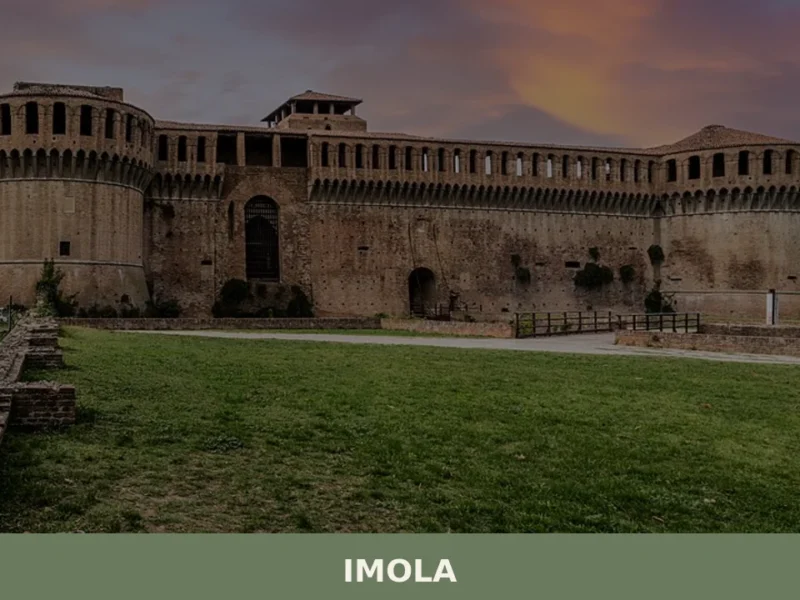
Imola
In 1953, on the track of the Autodromo Enzo e Dino Ferrari, Formula One cars raced in the Italian Grand Prix, placing Imola firmly in international motorsport history. But this city of 69,121 inhabitants, spread out at 47 metres above sea level along the banks of the River Santerno, had already existed for two thousand […]
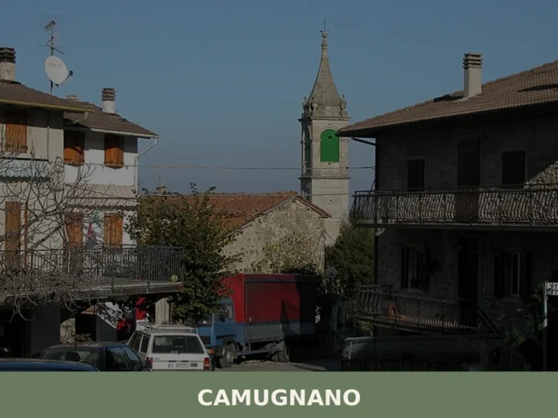
Camugnano
In 1911, when the construction of the Suviana Dam transformed the course of the Limentra torrent, Camugnano changed its appearance forever. The water submerged farmland and footpaths, creating an artificial reservoir that now defines the landscape of the upper Bolognese Apennines at an altitude of 692 metres. This municipality of 1,948 inhabitants, spread across scattered […]
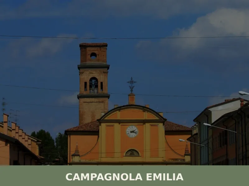
Campagnola Emilia
What to see in Campagnola Emilia, Italy: explore a Po Plain comune at 22 m altitude, 25 km from Reggio Emilia. Discover local festivals and food. Read the guide.
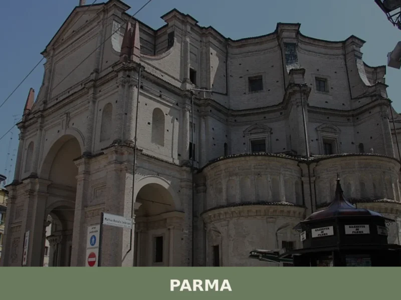
Parma
what to see in parma. Home to 177,714 residents, Parma offers the iconic Duomo, Baptistery, and world-famous Parma Ham. Explore its rich heritage.
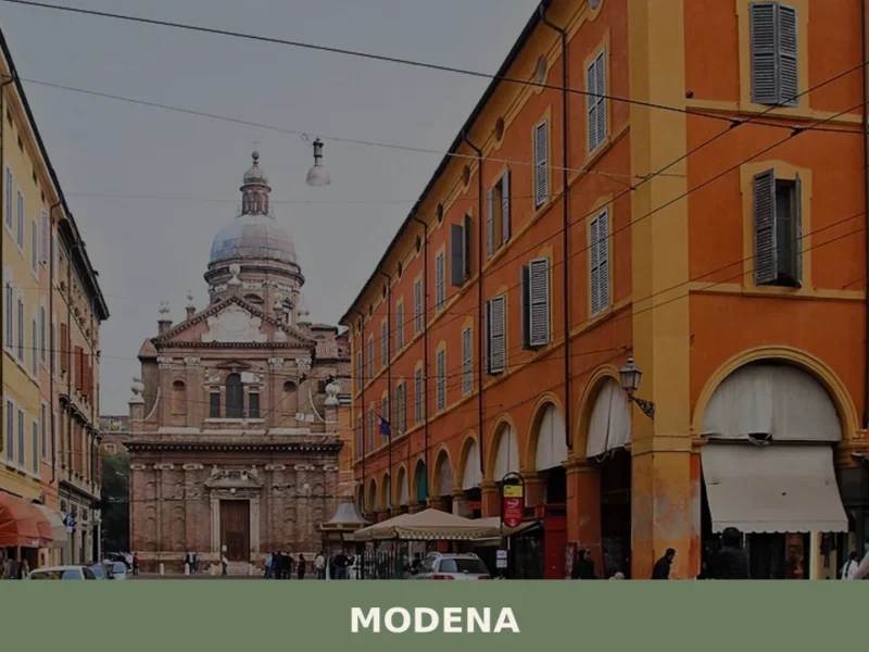
Modena
what to see in modena. Discover the UNESCO Duomo and Ducal Palace. Explore this city of 179,000+ residents and taste typical Modenese products.
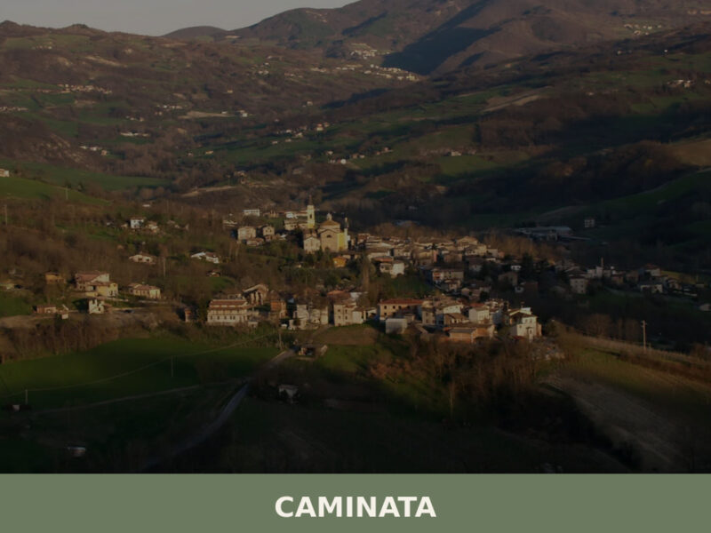
Caminata
Caminata sits at 364 metres in the Val Tidone, Piacenza province. A guide to its church, trails, Apennine food traditions, and surrounding landscape.
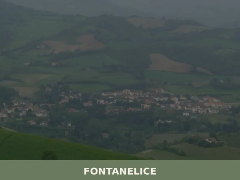
Fontanelice
The provincial road climbing the Santerno valley passes through Imola and, after a few kilometres, reaches a compact settlement along the right bank of the river: this is Fontanelice, a municipality of 1,951 inhabitants at 165 metres above sea level, in the province of Bologna. The very name of the village refers to water — […]
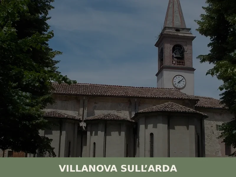
Villanova sull’Arda
In 1813, in the hamlet of Sant’Agata, Giuseppe Verdi was born — the composer who would rewrite the history of European melodrama. Villanova sull’Arda, home to 1,894 inhabitants in the Bassa Piacentina lowlands, still bears the marks of that bond: the villa where Verdi lived for over half a century with soprano Giuseppina Strepponi stands […]
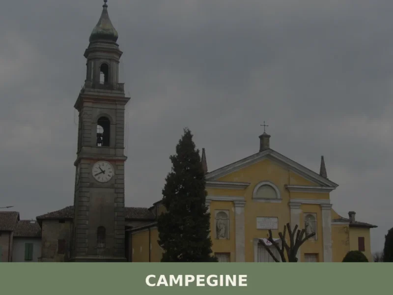
Campegine
What to see in Campegine, Emilia-Romagna, Italy: explore the hometown of the Cervi Brothers, local food traditions and festivals. Population 5,078. Discover now.


🏡 Know Albareto better than we do?
If you’re a local or have been there, your knowledge matters: add what’s missing or fix a detail on this page.