


What to see in Campolieto, Italy: 11 km from Campobasso, explore the historic centre, local cuisine and festivals. Discover this Molise village now.
Discover Campolieto
The road northeast out of Campobasso climbs into the Molise interior, where the land opens into rolling clay hills and the settlements grow smaller and farther apart. After 11 kilometres (7 mi), the cluster of houses that makes up Campolieto appears on the ridge, its rooflines cutting against a wide agricultural horizon. The surrounding municipalities — Castellino del Biferno, Matrice, Monacilioni, Morrone del Sannio, Ripabottoni, and San Giovanni in Galdo — form a ring of similarly compact communities across this inland stretch of the Province of Campobasso.
Knowing what to see in Campolieto means understanding a place built at roughly 650 m (2,133 ft) above sea level, where the pace of daily life still follows the rhythms of a small rural comune, or municipality.
Visitors to Campolieto find a compact historic centre with a parish church, a network of narrow lanes typical of Molise hill settlements, and direct access to the agricultural landscape that has shaped the village for centuries. The distance from Campobasso — just 11 km (7 mi) — makes it a straightforward half-day excursion from the regional capital.
History of Campolieto
The name Campolieto combines the Italian words for field — campo — and the adjective lieto, meaning glad or pleasant, a designation that likely reflects the productive character of the surrounding agricultural land rather than any specific founding event. Villages across this part of Molise share names of Latin or medieval origin tied to the physical features of their territory, and Campolieto follows that pattern.
The settlement occupies a position typical of medieval Samnite hill communities: elevated enough to provide visibility across the valley, close enough to arable land to sustain a farming population.
The broader Province of Campobasso, within which Campolieto sits, carries a long history of Samnite settlement followed by Roman incorporation, Lombard rule, and the various Norman and Aragonese dominions that reorganised southern Italy through the medieval period. Small villages like Campolieto functioned within feudal structures throughout these centuries, their populations engaged primarily in cereal cultivation, sheep farming, and the seasonal transhumance routes that crossed the Apennine interior. The geography of the area — clay ridges between river valleys — determined the location and scale of each settlement, and Campolieto is no exception to this pattern.
In more recent history, Campolieto formalised an international connection by establishing a twin-town relationship with Arese, a municipality in the Province of Milan, in 2006. This kind of twinning between a small Molise village and a northern Italian town often reflects the emigration flows of the twentieth century, when many families from the rural south relocated to the industrial north for work, maintaining cultural and administrative ties with their places of origin.
The relationship with Arese is the most formally documented modern chapter in Campolieto’s institutional history. Visitors interested in the parallel histories of southern Italian villages and northern industrial growth will find this connection a useful lens for understanding the demographics of the entire region. The nearby village of Baranello, also in the Province of Campobasso, shares comparable patterns of rural development and twentieth-century demographic change.
What to see in Campolieto, Molise: top attractions
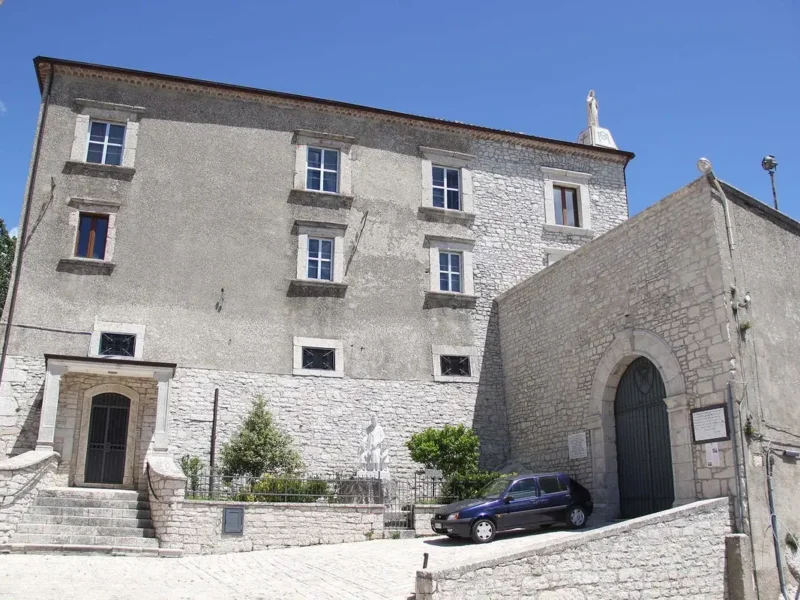
The Parish Church of the Historic Centre
The parish church stands at the core of Campolieto’s built environment, as is typical of Molise hill settlements where the religious building served as the social and spatial anchor of the community. Stone construction dominates the facade, with the masonry reflecting the local building materials available in the Province of Campobasso. The interior layout follows the single-nave plan common to rural churches of the medieval and early modern periods in this part of southern Italy. If you visit in the morning, the light through the windows falls across the altar in a way that reveals the texture of the plasterwork clearly. Look for any surviving decorative elements in the apse, which often preserve older artistic layers in village churches of this type.
The Village Lanes and Historic Street Plan
Campolieto’s street plan reflects the compact, defensive logic of medieval Molise settlement, where lanes were kept narrow to channel movement and conserve heat in winter.
Walking the central streets takes no more than thirty minutes at a slow pace, but the sequence of stone facades, external staircases, and recessed doorways gives a clear reading of how the village was built and extended over several centuries. The elevation of roughly 650 m (2,133 ft) means views across the surrounding hills extend for considerable distances on clear days, particularly to the east and south. For those interested in vernacular architecture, the variation in stone coursing along the older walls — some sections using larger irregular blocks, others with more uniform cut stone — documents different phases of construction without requiring any formal explanation.
The Agricultural Landscape and Ridge Viewpoints
The immediate surroundings of Campolieto consist of open agricultural land on clay-rich soil, a landscape type that characterises much of the Province of Campobasso between 400 m (1,312 ft) and 700 m (2,297 ft) elevation. From the ridge on which the village stands, the geometry of cultivated fields — cereal plots, fallow sections, and occasional olive groves — extends across several kilometres in each direction. This is not a dramatic mountain landscape but a working agricultural one, and the visual interest lies in the scale and organisation of land use rather than in natural spectacle. The best viewpoints are at the outer edges of the village where the road verges meet the field boundaries, accessible on foot from the main square in under ten minutes.
The Municipal Territory and Boundary Villages
Campolieto borders six municipalities — Castellino del Biferno, Matrice, Monacilioni, Morrone del Sannio, Ripabottoni, and San Giovanni in Galdo — and the roads connecting them pass through a varied sequence of Molise hill terrain.
Driving the local roads between these villages covers distances of between 5 km (3.1 mi) and 15 km (9.3 mi) and provides a structured way to understand the settlement pattern of this part of the province. Each boundary village has its own church, piazza, and street plan developed independently over centuries, making the circuit of the municipal boundaries a half-day route with consistent historical content at each stop. For context on a comparable village in a different part of Molise, Agnone in the Province of Isernia offers a larger and more extensively documented historic centre.
The Connection to Campobasso: Day Context
At 11 km (7 mi) from Campobasso, Campolieto sits within the immediate orbit of the regional capital, and any visit to the village fits naturally into a broader day focused on the province. Campobasso itself, at approximately 50,000 inhabitants, holds the Museo Sannitico and the medieval upper town with the Castello Monforte, both of which provide substantial historical and archaeological context for the smaller villages of the surrounding area. The drive from Campobasso to Campolieto takes approximately 15 to 20 minutes depending on route.
Combining the two in a single day is entirely practical, with Campolieto serving as the quieter rural counterpart to the administrative centre.
Local food and typical products of Campolieto
The food culture of Campolieto belongs to the wider culinary tradition of inland Molise, a region whose isolation from major trade routes for most of its history produced a cuisine built on what the land and animal husbandry could reliably supply. Cereals, legumes, pork, sheep’s milk, and seasonal vegetables form the structural base. The influence of the Apennine transhumance economy — with its emphasis on preserved meats and aged cheeses designed for long storage — runs through every layer of the local food tradition. Campobasso province, of which Campolieto is a part, sits at the intersection of the Samnite interior and the lowland grazing routes that connected the Abruzzo highlands with the Tavoliere plain in Puglia.
Pasta prepared by hand remains central to the table in Molise villages. Pasta e fagioli, a thick soup of hand-rolled pasta pieces and dried borlotti beans cooked with garlic, olive oil, and dried chilli, appears on domestic tables throughout the colder months and is one of the most direct expressions of the ingredient logic of the interior.
Agnello al forno — oven-roasted lamb seasoned with rosemary, garlic, and white wine — reflects the sheep-farming economy that has sustained this part of the province for generations. During the winter slaughter season, salsiccia sotto sugna, a pork sausage preserved under rendered lard in ceramic vessels, is prepared in private homes across the area. The technique extends shelf life without refrigeration and produces a dense, intensely flavoured meat that is eaten sliced with bread or crumbled into sauces.
Sheep’s milk cheese produced in the inland areas of Campobasso province ranges from fresh caciotta — soft, mild, eaten within days of production — to harder aged forms that develop a sharper flavour over weeks. No specific certified designation is documented for Campolieto’s immediate territory in the available sources, but the broader Molise cheese tradition includes products under the Caciocavallo Silano DOP designation, which covers areas of the southern Apennines including parts of Molise.
Local markets and farm shops in the villages surrounding Campobasso are the most direct point of access for these products. The village of Palata, in the southern part of Campobasso province, participates in the same broad food tradition of the Molise interior.
Small-scale production of olive oil using olives grown at the lower elevations of the municipal territory supplements the diet and appears in most local dishes as the primary cooking fat. The best period to find freshly pressed oil is November, immediately after the autumn harvest. Village festivals, discussed in the section below, often coincide with the harvest calendar and provide the most direct opportunity to encounter locally produced food in a communal context.
Festivals, events and traditions of Campolieto
Like most villages in Campobasso province, Campolieto organises its public calendar around the feast day of its patron saint, a celebration that combines a religious procession through the village streets with communal gathering in the main square.
The specific date of the patron saint’s feast is tied to the liturgical calendar and draws residents and former inhabitants — many of whom may have relocated to larger centres during the twentieth century — back to the village for the occasion. The procession typically involves the carrying of a statue of the patron through the main streets, accompanied by local musicians and followed by an outdoor meal or sagra, a traditional local food festival centred on specific seasonal dishes.
The twinning with Arese, established in 2006, has created an additional axis for cultural exchange between Campolieto and the northern Italian municipality. Such twin-town relationships in Molise are frequently marked by reciprocal visits, joint events, and the kind of administrative cooperation that keeps emigrant communities connected to their village of origin across generations. Beyond formal events, the daily rhythms of village life — the morning market, the seasonal agricultural work, the gatherings at the central bar — constitute the actual texture of social life in Campolieto across the year.
When to visit Campolieto, Italy and how to get there
The best time to visit Campolieto and the surrounding villages of the Campobasso province is late spring — May and June — when the agricultural landscape is at its most productive, temperatures at 650 m (2,133 ft) elevation remain comfortable between 18°C (64°F) and 24°C (75°F), and the main festival season begins.
Early autumn, September through October, offers a second good window: the harvest is underway, the heat has dropped from summer levels, and the light across the clay hills in the afternoon has a particular clarity. Winter at this elevation brings cold temperatures and occasional snow, which closes some secondary roads. Summer brings heat and dry conditions but also the concentration of local festivals.
Getting to Campolieto is most practical by car. From Campobasso, the drive northeast covers 11 km (7 mi) and takes approximately 15 to 20 minutes on the provincial road network. From Rome, the distance is approximately 230 km (143 mi) via the A1 motorway to Caianello and then the SS17 and SS87 towards Campobasso, with a total travel time of around two and a half to three hours. Campobasso railway station is served by Trenitalia regional connections from Naples (approximately 2 hours 30 minutes) and from Isernia.
From Campobasso station, the onward journey to Campolieto requires a car or taxi, as no scheduled bus service to the village appears in current timetables. The nearest commercial airport is Naples Capodichino, approximately 180 km (112 mi) to the south, from which a hire car or coach to Campobasso and then a local transfer are the practical options. International visitors should be aware that English is not widely spoken in smaller shops and bars in villages of this size; carrying Euros in cash is advisable, as card payment infrastructure is limited outside Campobasso itself.
For those planning a longer circuit of the province, Acquaviva d’Isernia in the neighbouring Province of Isernia offers a comparable rural village experience and can be combined with Campolieto in a two-day itinerary covering the main settlement types of the Molise interior. The road distance between the two provinces is manageable, and the contrast between the Campobasso clay hills and the rockier Isernia terrain makes the comparison worthwhile for visitors with a specific interest in the geography of inland southern Italy.
Frequently asked questions about Campolieto
What is the best time to visit Campolieto?
The best time to visit Campolieto is in late spring (May-June) or early autumn (September-October) when the weather is mild, ideal for walking the village lanes and enjoying the expansive views across the agricultural landscape. September 29th is particularly significant as it marks the Festa Patronale in honour of San Michele Arcangelo, offering a glimpse into local traditions. While winters are colder, they are perfect for experiencing the rich, hearty Molise cuisine, such as pasta e fagioli or salsiccia sotto sugna, in a cozy, authentic setting at an altitude of 735 meters.
What to see in Campolieto? Main monuments and landmarks
In Campolieto, the primary landmark is the Parish Church, a stone construction typical of Molise hill settlements, serving as the community's historical and social anchor. Its single-nave interior offers a glimpse into medieval and early modern rural architecture. Exploring the compact historic centre's narrow village lanes, a walk of about thirty minutes, reveals centuries of vernacular architecture, stone facades, and external staircases. Don't miss the Agricultural Landscape and Ridge Viewpoints at the village's outer edges, easily accessible on foot from the main square in under ten minutes, offering expansive vistas over the cultivated fields of the Molise interior.
What are the main natural or scenic attractions of Campolieto?
The main natural attraction in Campolieto is its expansive agricultural landscape, characterized by rolling clay hills and cultivated fields. From the village's elevated position at 735 meters, particularly from the Ridge Viewpoints at its outer edges (accessible within ten minutes from the main square), visitors can enjoy far-reaching panoramas. While not a dramatic mountain setting, the visual interest lies in the scale and organization of the working farmland, offering a serene and authentic Molise rural experience on clear days, especially towards the east and south. The elevation of roughly 650 meters means views extend for considerable distances.
Where to take the best photos in Campolieto?
For the best photos in Campolieto, focus on the panoramic Ridge Viewpoints located at the outer edges of the village, easily reachable on foot from the main square in under ten minutes. These spots offer expansive, clear views across the rolling agricultural landscape to the east and south, particularly striking on clear days. Within the historic centre, the Parish Church, with its characteristic stone facade, provides a focal point, while the narrow, winding village lanes with their stone facades and external staircases offer charming opportunities for capturing the vernacular architecture and timeless atmosphere of this Molise settlement, reflecting its medieval street plan.
Are there museums, churches or historic buildings to visit in Campolieto?
Yes, Campolieto features the Parish Church within its historic centre, which is a significant historic building to visit. This church stands as the community's social and spatial anchor, constructed with local stone masonry. Its interior typically follows a single-nave plan common to rural churches of the medieval and early modern periods in southern Italy. While specific opening hours are not formally documented, it is generally accessible during daylight hours or for religious services. No museums or other formally designated historic buildings for public visit are mentioned for Campolieto itself.
What can you do in Campolieto? Activities and experiences
In Campolieto, visitors can immerse themselves in the quiet rhythm of a rural Molise village. Activities include walking through the compact historic centre, exploring its narrow lanes and vernacular architecture, and enjoying the expansive views from the ridge viewpoints. A scenic drive through the surrounding municipalities like Castellino del Biferno or Monacilioni offers insight into the regional settlement patterns. For a cultural experience, plan your visit around September 29th for the Festa Patronale of San Michele Arcangelo. Campolieto also serves as an excellent, tranquil half-day excursion from Campobasso, just 11 km away, offering a contrast to the regional capital.
Who is Campolieto suitable for? Families, couples, hikers, solo travelers?
Campolieto is ideal for travelers seeking a tranquil, authentic Molise experience away from crowded tourist routes. It's particularly suitable for solo travelers and couples interested in exploring small, historic Italian villages, vernacular architecture, and rural landscapes. Those with an interest in local history, the region's emigration patterns (reflected in its twinning with Arese), and traditional Molise cuisine will find it rewarding. While not offering extensive hiking trails or specific child-focused attractions, it's perfect for a relaxed half-day visit or as a quiet base for exploring the surrounding Province of Campobasso, offering a slower pace of daily life.
What to eat in Campolieto? Local products and specialties
In Campolieto, you can savor the authentic culinary traditions of inland Molise, deeply rooted in local agriculture and animal husbandry. Specialties include hand-rolled pasta dishes like u0022Pasta e fagioli,u0022 a hearty soup with borlotti beans, perfect for colder months. u0022Agnello al forno,u0022 oven-roasted lamb seasoned with rosemary and garlic, highlights the region's sheep farming economy. During winter, look for u0022salsiccia sotto sugna,u0022 a flavorful pork sausage traditionally preserved under lard in ceramic vessels. Local sheep's milk cheeses range from fresh u0022caciottau0022 to aged varieties, and while no specific DOP is exclusive to Campolieto, the broader Molise tradition includes u0022Caciocavallo Silano DOP.u0022
Getting there
Via Olmo San Bernardino, 86040 Campolieto (CB)
Nearby Villages near Campolieto
In Molise More villages to discover
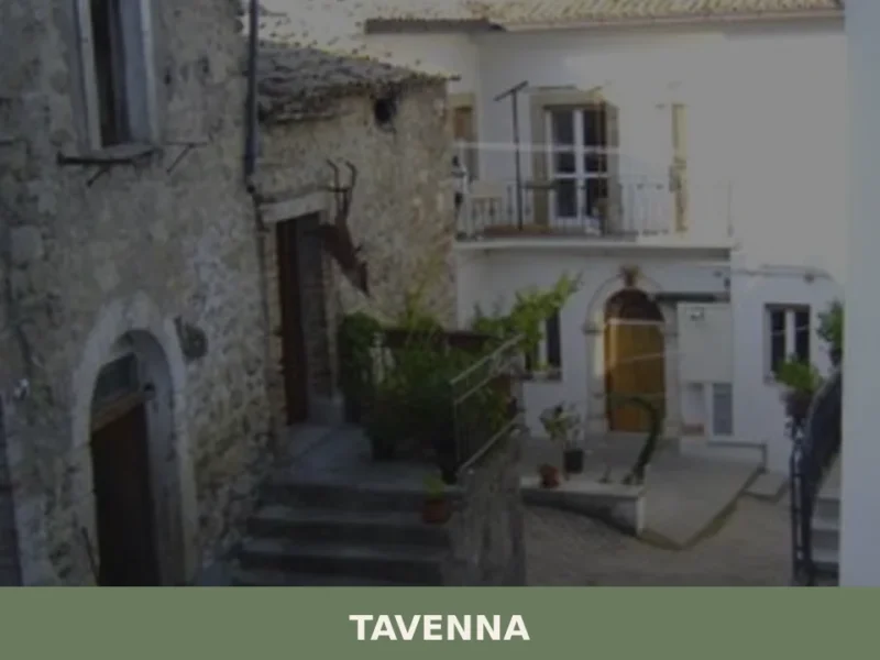
Tavenna
A complete guide to Tavenna in Molise: its medieval stone centre, parish church, panoramic hillside views, and the quiet rhythms of inland southern Italy.
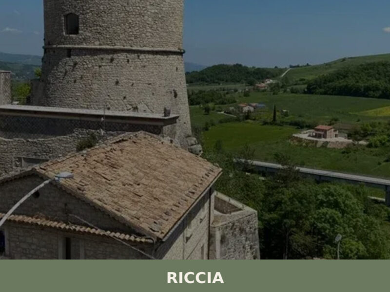
Riccia
A hilltop village of 4,814 inhabitants in the province of Campobasso, Riccia reveals medieval streets, a Norman castle, and one of Molise's most celebrated food festivals.
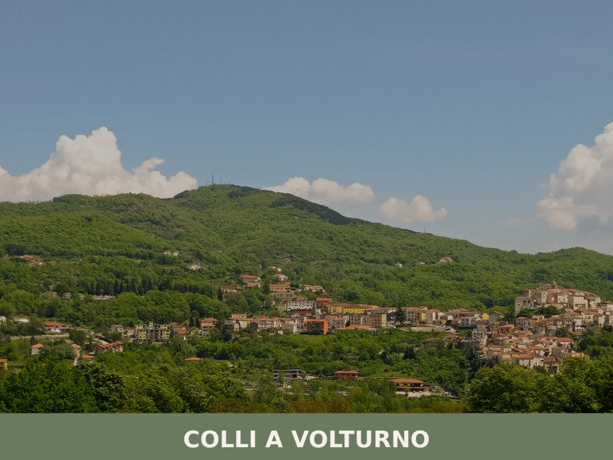
Colli a Volturno
Colli a Volturno is a hillside comune of around 1,270 people in the province of Isernia, Molise, with Benedictine medieval origins, surviving castrum gates, and a landscape stretching across the Valle
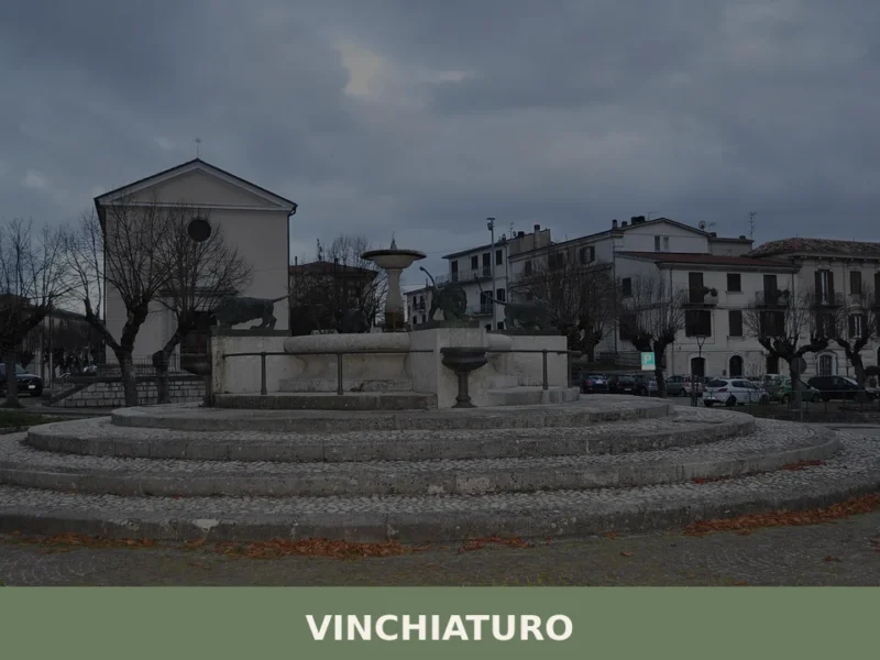
Vinchiaturo
Morning mist settles into the valley below as church bells mark the hour from somewhere above the rooftops. At 620 metres above sea level, the air in Vinchiaturo carries a sharpness that cuts through the warmth of Molise’s interior hills. With just over 3,300 inhabitants, this is a village where the rhythm of daily life […]
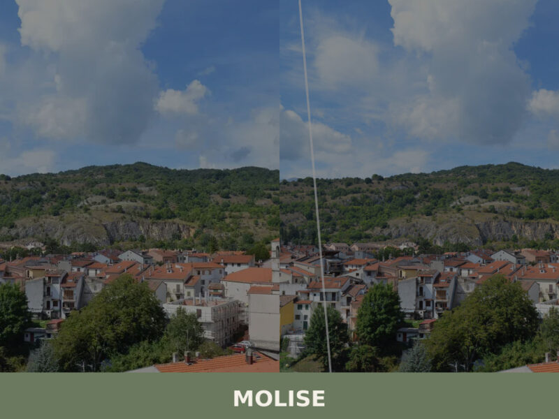
Molise
Molise is Italy's youngest and least-visited region. From Samnite theatres to Adriatic fishing towns, here is what to see in Molise.
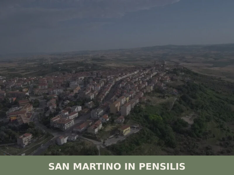
San Martino in Pensilis
Morning light catches the pale stone of a church bell tower, and below it, the long main street empties into a piazza where a handful of men stand with espresso cups, talking over one another. San Martino in Pensilis sits at 281 metres above sea level in the province of Campobasso, a settlement of roughly […]
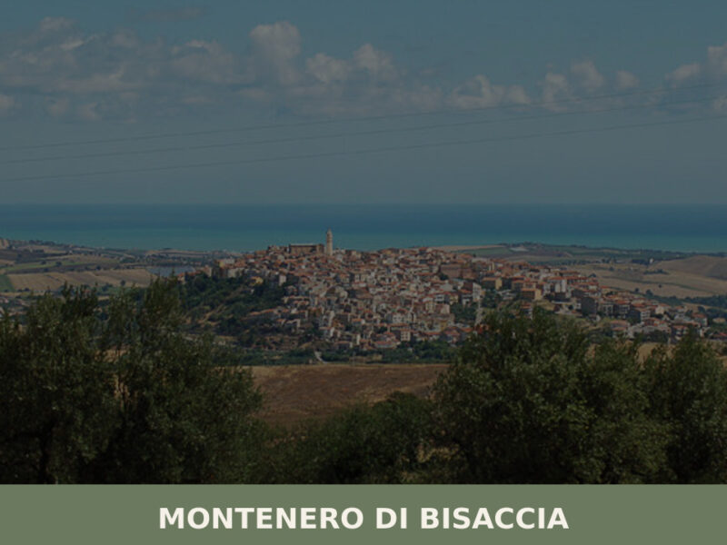
Montenero di Bisaccia
Morning light moves across the rooftops in a slow wave, catching the sandstone walls of old houses before spilling into the main piazza. At 273 metres above sea level, Montenero di Bisaccia sits on a hill that commands views stretching from the Apennine ridgeline to the Adriatic coast — a rare double horizon. With just […]
Cercemaggiore
Cercemaggiore is a hilltop village in inland Molise, sitting at around 945 metres above sea level with a landscape of oak woodland, grazing land, and long Apennine ridgelines.
Gambatesa
Gambatesa is a hilltop commune in the province of Campobasso, Molise, built around a medieval castle that was transformed into a Renaissance residence by the Di Capua family and remains the centrepiec
Acquaviva d’Isernia
Discover what to see in Acquaviva d'Isernia: history, food, best time to visit, and how to reach this small Molise village in the Isernia uplands.


🏡 Know Campolieto better than we do?
If you’re a local or have been there, your knowledge matters: add what’s missing or fix a detail on this page.