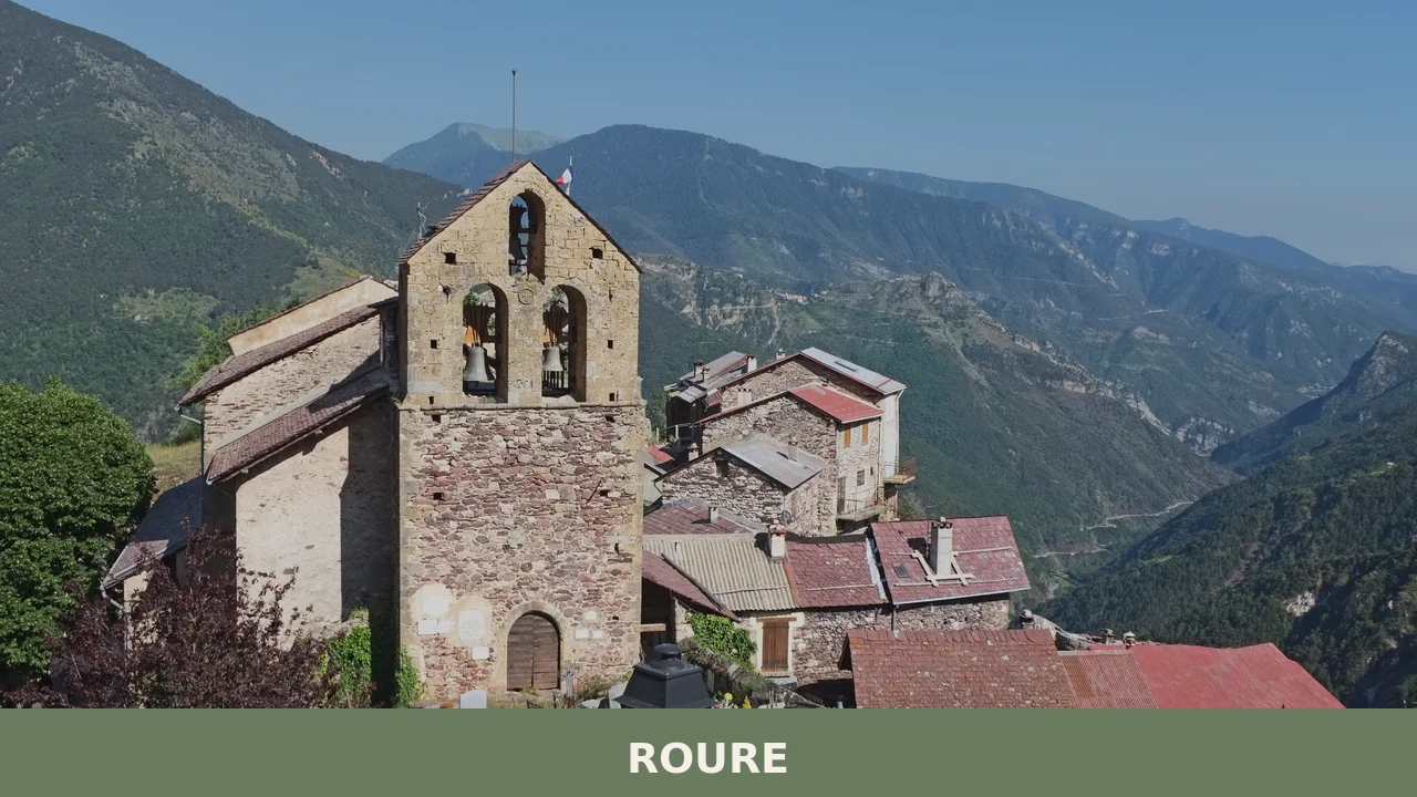
Stone hamlets cling to the steep sides of Val Chisone, their terracotta roofs weathered to the colour of mountain granite. Roure announces itself not as a single village square but as a scattering of inhabited fractions—Balma, Roreto, Villaretto, Castel del Bosco—each a cluster of houses built where the slope permits. Water sounds constantly: the torrente Chisone flows through the valley bottom, while smaller streams rush down the ravines between settlements. At 860 metres altitude, stone pathways and mountain air define the rhythm of daily life.
Roure village in Piedmont belongs to the Turin metropolitan area and sits within the Occitan valleys, a territory where language, cuisine and settlement patterns reflect centuries of alpine life. For visitors, the main draws are the granite climbing routes that have developed since the 1970s on the valley’s vertical walls, and the network of alpine lakes and mountain refuges that connect this dispersed commune to the broader Orsiera Rocciavrè park landscape.
A Name Restored: From Occitan Roots to Fascist Erasure and Back
The name Roure carries botanical and linguistic weight. It derives from the Occitan term roure, meaning oak or English oak, which itself traces to the Latin rōbur-rōboris—a word denoting strength, durability, hardness and resistance. The same Latin root underlies the modern Italian adjectives robusto (sturdy) and robustezza (robustness). The village’s identity rested in this name for centuries.
During the Fascist period, the regime deemed the name too French in sound and insufficiently Italian. In 1937 it was changed to Roreto, then in 1939 altered again to Roreto Chisone. Though the oak symbol remained in the municipal coat of arms, the original etymology was lost. This imposed identity persisted until 1975, when residents approved a referendum to restore the historical name Roure. The restoration marked a reassertion of local identity after decades of erasure.
A name is not merely a label; it is a link to the mountain’s memory. When Roure was recovered in 1975, the village reclaimed its voice in the Occitan dialect and geography of the high valleys.
Demographic pressures have shaped the modern reality. Since 1951, the resident population has halved—a fate shared by many alpine communes. The territorial administration once operated within the Valli Chisone e Germanasca mountain community, later shifting to the Pinerolese mountain authority, binding Roure administratively to the broader valley network.
Mountain Terrain: Four Fractions and Vertical Granite Walls
Castel del Bosco and the Valley Floor
Castel del Bosco sits lowest in the commune, where the valley widens slightly at the boundary with neighbouring Perosa Argentina. This fraction marks the entry point into Roure’s dispersed settlement pattern. Stone houses here face both the Chisone’s course and the forested slopes rising steeply behind them. Access by road follows the main valley track, making this fraction the gateway for vehicles arriving from downstream communities.
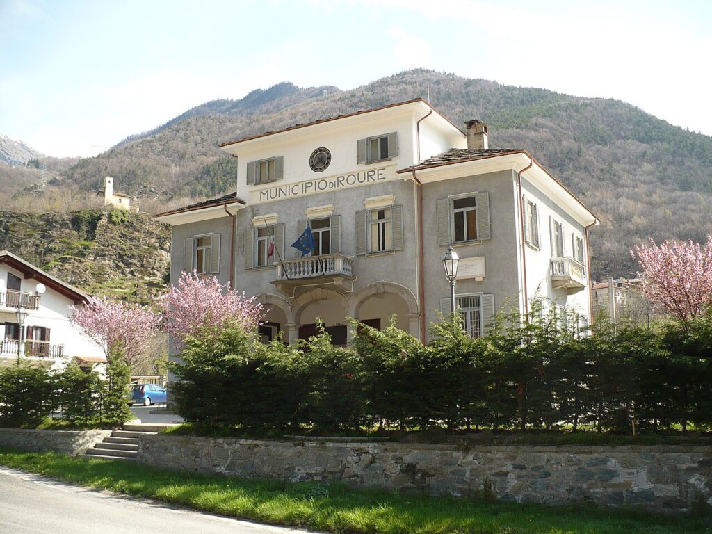
Balma and the Administrative Core
Balma holds the municipal seat and functions as the commune’s administrative centre. Positioned in the mid-valley, it serves as a reference point for residents scattered across the higher fractions. The term balma itself appears also in local river names and may refer to rock shelters or overhanging stone formations in alpine geology. From here, paths lead upward toward Roreto and the dramatic Vallone di Bourcet.
Roreto and the Vallone di Bourcet
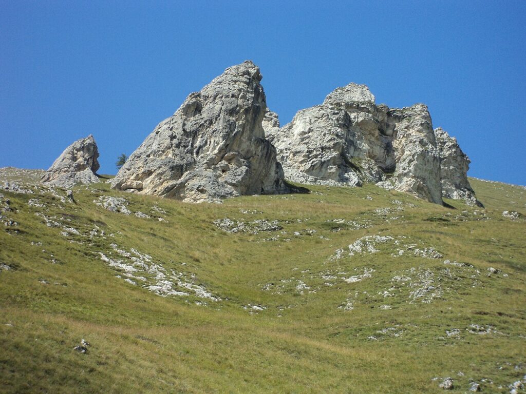
Roreto marks the junction where the Vallone di Bourcet opens northwestward into the mountain wall. The Vallone di Bourcet spans nearly two thousand metres of elevation change. The lower reaches of the vallone combine wild terrain with accessible climbing ground. The via ferrata Nicola Ciardelli traces the start of this ravine, offering climbers a protected route through the granite. Rope routes on the surrounding walls reach up to 300 metres in length, with grades extending to the seventh technical level, making this one of the valley’s primary climbing destinations.
Villaretto and the Hydroelectric Basin
Villaretto lies northwest, bordering Fenestrelle, and contains the Villaretto hydroelectric basin at 973 metres. This frazione represents the highest accessible settlement by vehicle within the commune. Smaller hamlets—Serre del Bosco, Nouflieres, Vignal, Piccolo and Gran Faetto—scatter across the mountainside, most now thinly populated or abandoned but visible as ruins in the landscape.
Alpine Lakes and Mountain Refuges
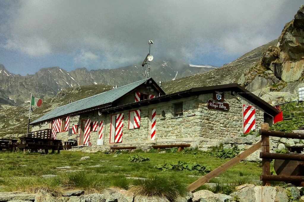
A chain of high-altitude lakes marks the territory’s upper watershed. Lago Laus (2,270 m), Lago Jouglard (2,365–2,379 m), Lago Rouen (2,391 m) and Lago Ciardonnet (2,558 m) punctuate the plateau and cirque basins above the main valleys. Refuges and bivouacs serve mountaineers and hikers: Rifugio Selleries (2,040 m) in the Orsiera Rocciavrè park, Rifugio Serafin Di Charrier in Bourcet, and several bivouacs near the major lakes. These anchors enable multi-day mountain traverses across the commune’s high terrain.
Granite Routes and Climbing Heritage
Since the 1970s, Roure’s vertical granite walls have attracted climbers seeking year-round access at modest altitude. The Vallone di Bourcet and surrounding rock faces offer routes of varied difficulty and length. Modern development has transformed the climbing infrastructure with standardised bolts and modern equipment, converting what was once wild terrain into a recognised climbing zone. The combination of reasonable elevation, weather accessibility across seasons, and dramatic vertical relief has made Roure one of the established climbing areas in the surrounding valleys.
Mountain Flavours and Alpine Agriculture
The alpine meadows and terraced gardens of Roure produce vegetables and dairy typical of high-altitude Piedmont. The region’s certified products include the Nocciola del Piemonte (Piedmont hazelnut, IGP), Toma Piemontese cheese (DOP), and Marrone della Valle di Susa (Susa valley chestnut, IGP)—though these are regional products that reflect the broader Piedmont economy rather than unique local specialities. Mountain herds and small-scale cultivation sustain local food traditions adapted to short growing seasons and steep terrain.
Foraging traditions—mushrooms, herbs, berries in season—connect residents and visitors to the seasonal rhythm of the mountains.
Planning Your Visit to the Mountains
Roure is best reached by car, as public transport serves the valley minimally. The commune sits on route SS23, which climbs toward the Colle del Sestriere. The drive follows the Chisone valley, offering scenic views of gorges and rock formations. Winter conditions occasionally affect mountain roads; spring through autumn provide optimal access.
Summer is the primary season for outdoor visitors seeking climbing, hiking and alpine lake exploration. Milder temperatures extend into September. Spring brings wildflower meadows and clear water in the streams; autumn offers colour and solitude. Winter transforms the high passes and reduces accessibility, though the lower fractions remain inhabited and road access is maintained. Accommodation options are limited—local guesthouses and mountain refuges serve visitors, but booking ahead is essential, particularly during climbing season.
Nearby valley communities such as Pomaretto, Pragelato, and Prali lie within 30 kilometres, offering alternative bases and complementary routes through the Occitan mountain zone.
| Departure Point | Distance | Driving Time |
|---|---|---|
| Turin city centre | ~50 km | 60–90 minutes |
| Pinerolo | ~25 km | 45–60 minutes |
| Pinerolo (SS23) | ~25 km | 45–60 minutes |
The village calendar follows alpine rhythms rather than tourist seasons. Local authorities maintain basic services year-round. Check conditions before winter visits and allow flexibility for weather-related closures on high passes.