


Campotosto
At 1,420 metres beside one of Europe’s largest artificial lakes, Campotosto offers wild Apennine landscapes, cured mortadella, and trails into the Gran Sasso National Park.
Discover Campotosto
Morning light crosses the surface of the lake in long, silver bands, and the air at 1,420 metres carries the particular silence of high-altitude water — a stillness broken only by the occasional call of a marsh harrier circling above the reed beds. Campotosto, a village of just 458 inhabitants in the province of L’Aquila, sits at the edge of one of the largest artificial lakes in Europe. For anyone asking what to see in Campotosto, the answer begins here, at the shoreline, where the built world and the wild Apennines negotiate an uneasy, beautiful border.
History of Campotosto
The name itself records the landscape: Campus Tostus, the “parched field,” a reference to the harsh, wind-scoured plateau that settlers found when they first established communities here in the early medieval period. Documents from the 12th century place the settlement within the feudal domains that shifted between the counts of nearby territories and the Kingdom of Naples. Like many high-altitude villages in the central Apennines, Campotosto’s strategic value was not military but pastoral — its economy centred on transhumance, the seasonal movement of sheep between summer mountain pastures and the warmer coastal plains of Puglia.
The construction of the Lago di Campotosto between the 1930s and the early post-war years transformed the village’s identity. The dam project — part of Mussolini-era hydroelectric ambitions and completed by the national energy authority — flooded former grazing land and reshaped local livelihoods. Hamlets were displaced; others, like Mascioni and Poggio Cancelli, survived at the lake’s margins. The earthquake of 2009, centred on L’Aquila, and the seismic sequence of 2016–2017 brought further damage and depopulation, yet the village holds on, its stone buildings patched and reinforced, its community stubbornly present.
What to see in Campotosto: 5 must-visit attractions
1. Lago di Campotosto
Stretching roughly 14 kilometres at its longest axis and held at an elevation of 1,313 metres, this is one of the largest artificial lakes in Europe. A dirt-and-asphalt ring road traces its perimeter, popular with cyclists in summer and cross-country skiers in winter. The western shore, backed by the Gran Sasso massif, offers unobstructed views of Corno Grande, the highest peak of the Apennines at 2,912 metres.
2. The hamlet of Mascioni
A cluster of stone houses on the lake’s southern bank, Mascioni retains a medieval footprint that the main village has partly lost. Its church, dedicated to the Madonna delle Grazie, contains modest but intact 17th-century wooden furnishings. The hamlet functions as a quiet entry point to walking trails that ascend toward the Monti della Laga ridge, crossing beech forest and open grassland.
3. Church of Santa Maria Apparens
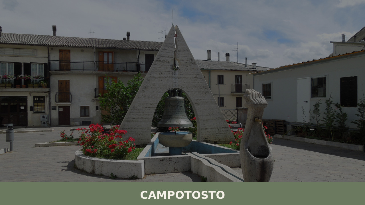
The parish church of Campotosto, rebuilt after seismic damage, preserves a simple stone façade and a painted wooden ceiling. Dedicated to an apparition of the Virgin — a common founding narrative in Abruzzo’s mountain churches — it stands near the village’s central piazza. Its bell tower, visible from several kilometres along the lakeshore road, serves as a navigational landmark.
4. Gran Sasso and Monti della Laga National Park
Campotosto lies within the boundaries of this national park, one of the largest protected areas in Italy. The Monti della Laga section, east of the lake, is defined by sandstone and marl geology — unusual for the Apennines — producing waterfalls during snowmelt. Golden eagles, Marsican brown bears, and Apennine wolves inhabit the higher elevations, though sightings require patience and early hours.
5. The lakeshore cycling and walking circuit
A roughly 40-kilometre loop encircles the lake, alternating between paved road and packed-earth track. The route passes through Poggio Cancelli and Ortolano, each with its own small church and water fountain. In late spring, the meadows flanking the path are dense with wild orchids, gentians, and narcissi — the altitude delays flowering by weeks compared to the valleys below.
Local food and typical products
Campotosto’s most recognised product is the mortadella di Campotosto, a small, oval pork salume with a strip of lard running through its centre — earning it the local nickname coglioni di mulo. Unlike industrial mortadella from Emilia-Romagna, this is a cured, air-dried product, traditionally made from free-range pigs and seasoned with salt, pepper, and white wine. It has attracted the attention of the Slow Food movement, which lists it as a Presidio. The salume is best eaten at room temperature, sliced thinly, alongside bread baked in wood-fired ovens.
The high altitude and cold winters also shape the cuisine. Lentils, potatoes, and barley form the base of thick soups. Lamb — a legacy of the transhumance economy — appears roasted with rosemary or stewed with saffron, the latter sourced from the nearby Navelli plateau. Local restaurants and agriturismi along the lakeshore serve these dishes with little ceremony, often in dining rooms that double as family kitchens. Pecorino cheese, aged in cellars carved from the village’s tufa-like stone, rounds out the table.
Best time to visit Campotosto
The lake is frozen from late December through February, and the village receives heavy snowfall — conditions that draw cross-country skiers and snowshoers but can make roads unpredictable. Spring arrives late at this altitude; May and June bring wildflower meadows and manageable temperatures around 15–20°C. Summer, from July to mid-September, is the peak period: the lake is open for fishing and kayaking, and the village holds its annual Sagra della Mortadella, typically in August, drawing visitors from across the province.
Autumn — October in particular — offers the clearest light and the fewest crowds. Beech forests on the Monti della Laga turn copper and gold, and the lake’s water level drops slightly, exposing mud flats where migratory birds pause. Be aware that some accommodation closes after mid-October and does not reopen until the Christmas period. Always check road conditions on the Abruzzo regional tourism portal before visiting in winter months.
How to get to Campotosto
Campotosto is reached most directly from L’Aquila, approximately 35 kilometres to the southwest via the SS80 and local connecting roads — a drive of about 45 minutes through mountain terrain. From Rome, the distance is roughly 150 kilometres: take the A24 motorway toward L’Aquila, exit at Assergi or L’Aquila Est, and follow signs north. From Teramo on the Adriatic side, the approach via the SS80 through the Monti della Laga takes about 50 minutes.
- Nearest airport: Rome Fiumicino (FCO), approximately 170 km; Pescara (PSR), approximately 120 km.
- Nearest train station: L’Aquila, with connections to Rome Tiburtina and Sulmona. From L’Aquila station, a local bus service (ARPA Abruzzo) runs to Campotosto, though schedules are limited — a rental car is strongly recommended.
- Road conditions: Winter tyres or chains are mandatory from November 15 to April 15 on all approach roads above 1,000 metres.
More villages to discover in Abruzzo
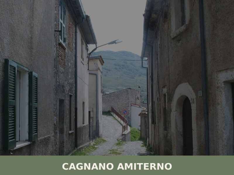
The mountains around Campotosto are scattered with small settlements that share a similar rhythm of seasonal isolation and quiet resilience. To the southwest, Cagnano Amiterno occupies the upper Aterno valley, a village linked to the ancient Sabine town of Amiternum and known for its underground catacombs and Roman-era remains. Its landscape is flatter, more open — a contrast to Campotosto’s lake-dominated geography — but the two villages share a common history of pastoral agriculture and seismic vulnerability.
Further south, on the western edge of the Fucino plain, Aielli has reinvented itself through a programme of large-scale murals painted across its medieval walls, transforming it into one of Abruzzo’s more unexpected cultural destinations. Where Campotosto’s appeal is elemental — water, stone, altitude — Aielli’s is artistic and contemporary. Together, they illustrate the range of what survives and adapts in Abruzzo’s interior, far from the coastal tourism of Pescara and Vasto.
Nearby Villages near Campotosto
Nearby villages we are mapping:
- Capitignano Abruzzo 📍 7 km Coming soon
In Abruzzo More villages to discover
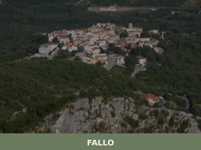
Fallo
With its 134 registered inhabitants, Fallo, in the province of Chieti, is confirmed as one of Abruzzo’s least populous settlements, a fact that immediately defines its intimate scale and unique relationship with the surrounding territory. This small urban cluster, situated on a rocky spur overlooking the Sangro valley, offers a genuine glimpse into Abruzzese mountain […]
Arsita
Until 1905, this village was called Bacucco, a name likely derived from the Latin bacuca, which referred to olives that had fallen to the ground — a direct reference to the agricultural character of the area. Situated at 470 metres above sea level on the hills of the Teramo province, Arsita and its 733 inhabitants […]
Fano Adriano
what to see in fano adriano, Italy: Discover 5 key attractions and local traditions in this Abruzzo village at 750 m (2,461 ft) altitude. Explore.
Lama dei Peligni
What to see in Lama dei Peligni: village at 669 m, Grotta del Cavallone, Majella National Park trails and arrosticini PAT. Plan your visit with this complete guide.
Farindola
What to see in Farindola, Abruzzo, Italy: explore the 28 m Vitello d'Oro falls, Gran Sasso National Park and Pecorino di Farindola. Discover 1,569 inhabitants strong.
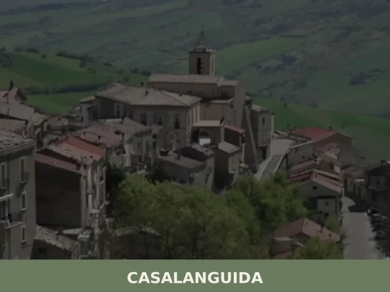
Casalanguida
With its 818 registered inhabitants and an elevation of 470 metres above sea level, Casalanguida occupies a hilltop ridge in the middle Sinello valley, in the province of Chieti. The municipal territory extends across vineyards and olive groves that mark the landscape with regular geometric patterns, visible from the provincial road that climbs up from […]
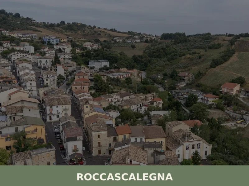
Roccascalegna
What to see in Roccascalegna, Abruzzo, Italy: castle, abbey, medieval village and 1,263 inhabitants. Discover top attractions, food and travel tips.
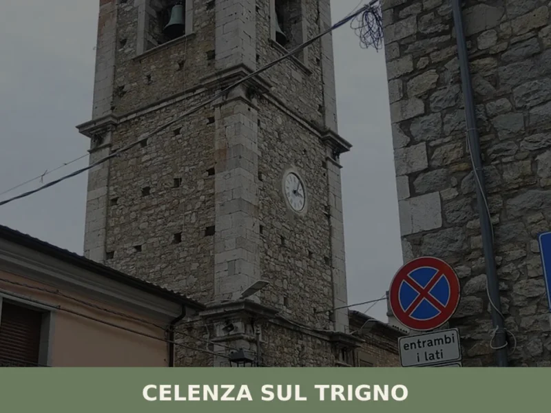
Celenza sul Trigno
At 646 metres above sea level, with 781 registered residents, Celenza sul Trigno occupies a ridge separating the Trigno river valley from the Treste stream, in the province of Chieti. The village appears in medieval documents as a Norman possession, and its urban layout preserves the concentric plan typical of 12th-century fortified settlements. Anyone wondering […]
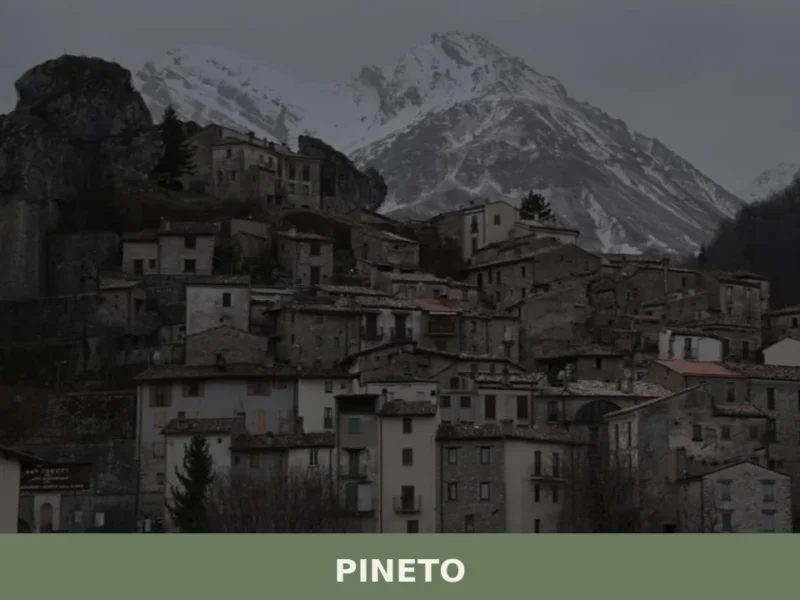
Pineto
what to see in pineto, Italy: Explore a coastal town at 4 m a.s.l., discover the historic Torre di Cerrano, and experience traditional festivals in Mutignano. Read our guide.
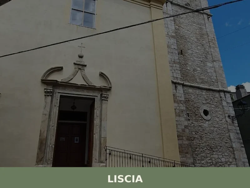
Liscia
What to see in Liscia: 642 residents, alt. 740 m. Discover Saint Michael's Church and arrosticini! Explore history and cuisine.


🏡 Know Campotosto better than we do?
If you’re a local or have been there, your knowledge matters: add what’s missing or fix a detail on this page.