


What to see in Antrodoco: discover the 5 main attractions, the history of this Lazio village and how to plan your visit. A complete guide for your itinerary.
Discover Antrodoco
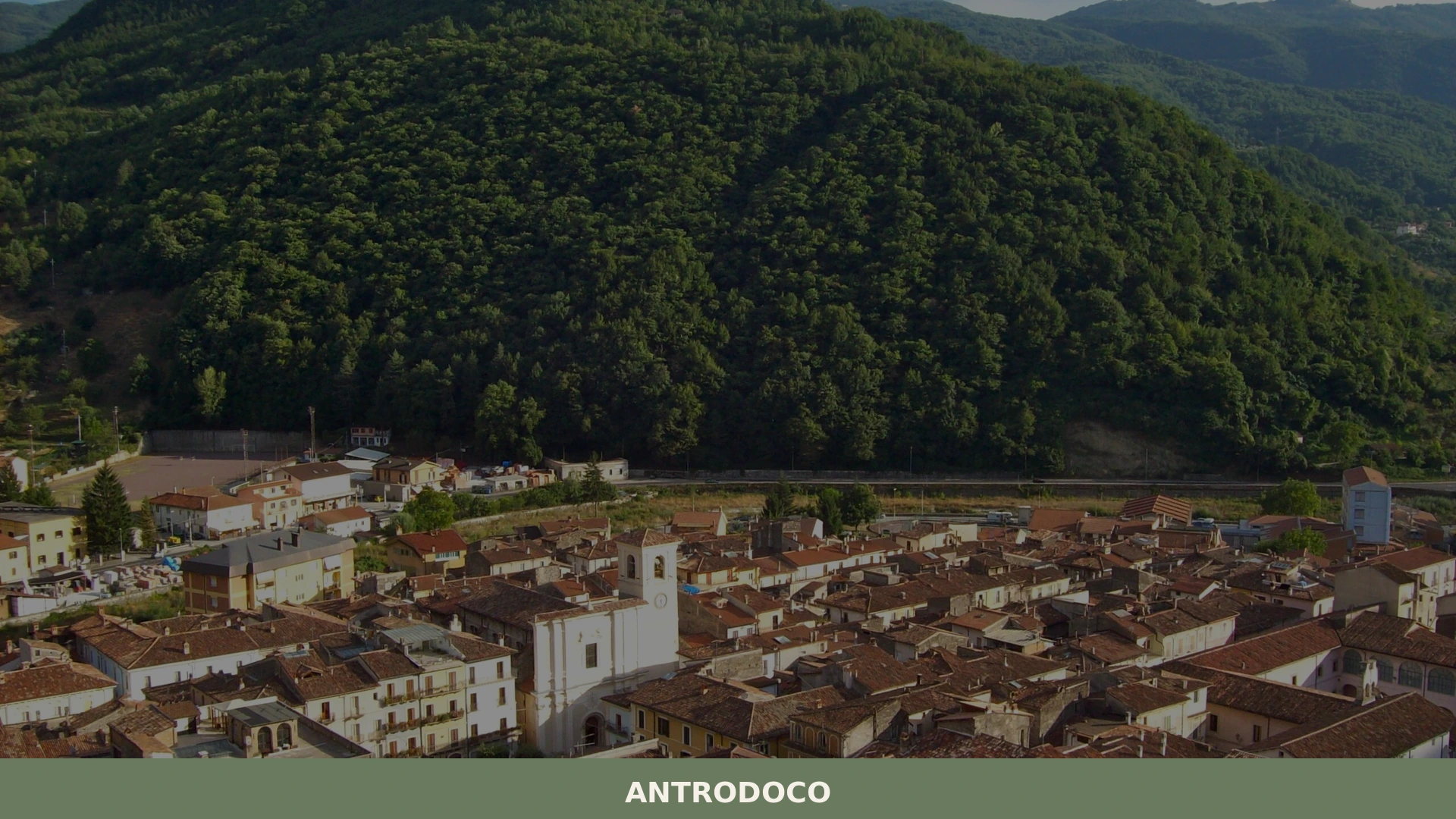
The Velino river carves a path through the Apennine mountains, forming deep, narrow canyons known as the Gole del Velino, where sheer rock faces rise dramatically from the water. This striking natural landscape defines the approach to Antrodoco, a village strategically positioned at the confluence of two such valleys.
The rugged terrain and the river’s persistent flow have shaped both the geography and the human settlement in this part of central Italy for millennia.
For those wondering what to see in Antrodoco, this central Italian village, situated in the province of Rieti, Lazio, offers a compelling blend of history and nature.
Visitors can explore at least 4 ancient churches and witness the dramatic Apennine canyons that surround the area. The Antrodoco highlights include its Roman heritage as a vital transportation hub and its striking natural setting, visible from miles away, making it a destination for both historical inquiry and scenic exploration.
History of Antrodoco
Antrodoco, known in Sabino as ‘Ndreócu, derives its name from the Latin Interocrea, which translates to “between the mountains,” a fitting description for its geographical position.
This strategic location along the Velino river, at the point where the Velino valley meets the Rio creek valley, has made it an important transportation hub since the time of the Roman Civilization. The village was notably crossed by the ancient Roman road, Via Salaria, a crucial artery connecting Rome to the Adriatic coast, and also served as the starting point of Via Caecilia, further cementing its role in the Roman road network.
The enduring significance of Antrodoco’s location is evident in its modern infrastructure, which largely mirrors these ancient routes.
The Strada statale 4 Via Salaria continues to link Antrodoco with Rome and the provincial capital Rieti to the west, extending north through the Gole del Velino canyon towards Amatrice, Ascoli Piceno, and the Adriatic coast.
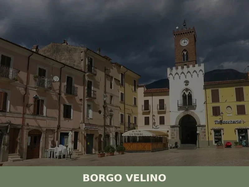
Similarly, the Strada statale 17 dell’Appennino Abruzzese branches from the Salaria in Antrodoco, connecting the town with L’Aquila by passing through the Gole di Antrodoco, demonstrating a continuous historical thread in regional connectivity. Exploring the historical connections between these valleys and settlements reveals a shared past with places like Borgo Velino, which also lies along the Velino river.
Beyond its ancient roads, the landscape around Antrodoco bears a more recent historical mark on Monte Giano, where the Gole di Antrodoco are located. Here, a distinctive pine tree forest was planted in 1939, meticulously shaped to spell the word “DVX,” the Latin term for duce.
This remarkable arboreal inscription is visible from miles of distance, providing a unique landmark that connects the natural environment with a specific period of 20th-century Italian history.
The village today functions as a comune in the province of Rieti, within the Lazio region of central Italy, continuing its legacy as a crossroads of culture and geography.
What to see in Antrodoco, Lazio: top attractions
Visitors seeking what to see in Antrodoco will find a series of historical churches and dramatic natural landscapes that reflect the village’s long history and unique geography.
Church of Santa Maria Assunta
The Church of Santa Maria Assunta stands as a central point of worship within Antrodoco, a village with deep historical roots dating back to Roman times. Its presence reflects centuries of spiritual life and community gatherings in the heart of the settlement. While specific construction dates are not detailed in historical records, such a church typically serves as a hub for local traditions and religious festivals, underscoring the enduring faith of its inhabitants.
Visitors will find this church integral to the urban fabric, a testament to the village’s continuous habitation and its role in local religious life for generations.
Santa Maria Extra Moenia
The church of Santa Maria Extra Moenia, whose name translates to “Saint Mary Outside the Walls,” points to a location historically situated beyond the original Roman settlement boundaries of Antrodoco.
This designation suggests an early Christian presence or the expansion of the original village beyond its defensive fortifications, indicating a significant historical footprint. Its existence highlights the spread of religious life and community development in the area over centuries. Exploring this site offers a glimpse into the growth of Antrodoco and the historical layers that define its urban landscape, providing a connection to its ancient past.
Santa Chiara
Dedicated to Saint Clare, the church of Santa Chiara likely indicates a historical association with the Poor Clares, a Franciscan order known for its contemplative life. This connection suggests the presence of a convent or monastery in Antrodoco at some point in its history, enriching the village’s spiritual and social fabric. These institutions often played vital roles in education, charity, and cultural preservation, contributing significantly to community life for many centuries.
Observing the architecture and location of such a church can offer insights into the religious orders that influenced the region.
Sant’Agostino
The church of Sant’Agostino, dedicated to Saint Augustine, represents another significant ecclesiastical presence within Antrodoco, testifying to the village’s rich religious heritage.
Churches bearing this dedication are frequently associated with the Augustinian orders, which have a long and influential history across Italy. While specific historical details about this particular structure are not extensively documented, its inclusion among the main sights underscores its importance to the local community and its role in the continuous narrative of faith in the region. These historical religious sites contribute to the cultural depth of Antrodoco.
The Gole del Velino and Gole di Antrodoco
The dramatic geological features of the Gole del Velino and Gole di Antrodoco represent the village’s most striking natural attractions. These are narrow canyons with sheer rock formations, carved by the Velino river and its tributary, the Rio creek, respectively. The Gole del Velino are located to the north of Antrodoco, while the Gole di Antrodoco cut through Monte Giano to the east.
On Monte Giano, a unique pine tree forest, planted in 1939, spells out the word “DVX” in Latin, a monumental arboreal inscription visible from many kilometers (miles) away, offering a distinct blend of natural beauty and historical symbolism.
Local food and typical products of Antrodoco
The available sources do not provide specific details regarding unique local dishes or certified food products directly associated with Antrodoco.
However, as a village situated in the Lazio region of central Italy, Antrodoco’s culinary traditions would generally align with the broader gastronomic heritage of the area, which emphasizes fresh, seasonal ingredients. The regional cuisine typically features robust flavors derived from local agriculture and traditional preparation methods, influencing the daily meals found in such communities.
While specific information on Antrodoco’s traditional recipes is not available, the Lazio region is renowned for dishes that often include ingredients like Pecorino Romano cheese, cured pork products, and various legumes. These staples form the basis of many hearty pasta dishes and stews.
Visitors might expect to find simple yet flavorful cooking, reflecting the agricultural bounty of the surrounding Apennine foothills and valleys, even if particular Antrodoco-specific dishes are not documented.
Festivals, events and traditions of Antrodoco
The provided sources do not contain specific information about festivals, events, or unique traditions celebrated in Antrodoco.
Therefore, details regarding patron saint festivals, local food fairs, or other documented customs are not available for inclusion. While most Italian villages possess a vibrant calendar of events, any specific celebrations for Antrodoco are not outlined in the current documentation.
Without verifiable data, it is not possible to describe particular processions, rituals, music, or fireworks that might characterize local festivities in Antrodoco. Visitors interested in attending such events would typically consult local tourism boards or municipal websites for up-to-date information on any scheduled activities.
The absence of specific listings in the provided sources means that a detailed account of Antrodoco’s unique traditions cannot be offered here.
When to visit Antrodoco, Italy and how to get there
For visitors planning a trip to Antrodoco, Italy, considering the best time to visit Lazio generally points to spring and autumn.
The months of April, May, September, and October offer mild temperatures, making them ideal for exploring the village’s historical sites and engaging in outdoor activities like hiking through the dramatic canyons. Summer, particularly July and August, can be warm to hot, which might suit those who enjoy warmer weather, though it can also be a busier tourist period. Winter brings cooler temperatures and the possibility of snow in the higher Apennine areas, appealing to those who appreciate a more serene, crisp atmosphere.
Antrodoco’s historical role as a transportation hub continues to define its accessibility.
The village is well-connected by road, primarily via the Strada statale 4 Via Salaria. This highway links Antrodoco directly with Rome and the provincial capital Rieti to the west, and extends north through the Gole del Velino towards Amatrice, Ascoli Piceno, and the Adriatic coast. Another significant route, the Strada statale 17 dell’Appennino Abruzzese, branches from the Salaria within Antrodoco, providing a direct connection to L’Aquila, passing through the Gole di Antrodoco.
These routes make Antrodoco accessible for a day trip from Rome or a longer exploration of central Italy.
For those preferring rail travel, Antrodoco has a station on the Terni–Sulmona railway line, offering train connections to Terni, Rieti, and L’Aquila.
While direct international air travel to Antrodoco is not available, the nearest major airport would be Rome Fiumicino (FCO), from which visitors can rent a car or take a train to a connecting city like Rieti or Terni before reaching Antrodoco. When traveling in Antrodoco and other smaller Italian villages, international visitors may find that English is limited in local shops and restaurants, so carrying some Euros cash can be useful for daily transactions.
Visitors to Antrodoco exploring central Lazio might also consider extending their trip to other villages in the region. For instance, Celleno offers a unique experience with its abandoned old town, while Anguillara Sabazia provides a lakeside setting on Lake Bracciano. Another option is to visit Colle San Magno, which shares a similar mountainous backdrop within Lazio.
Frequently asked questions about Antrodoco
When is the best time to visit Antrodoco?
Late July is ideal, coinciding with the Feast of Saint Anna on July 26th, the village's patron saint celebration featuring local traditions and festivities. Summer months offer pleasant weather for exploring the Apennine canyons and hiking trails. Spring and early autumn provide mild temperatures and fewer crowds, making them excellent for outdoor activities and scenic photography of the dramatic Velino gorges surrounding the village.
How do I get to Antrodoco by car?
Antrodoco is located in the province of Rieti, Lazio, in central Italy. The nearest major motorway is the A24/A25 (Rome-Teramo). From Rome, take the A24 toward L'Aquila, exiting toward Rieti. Follow provincial roads toward Antrodoco, positioned at 525 metres elevation in the Apennine region. The village sits strategically at the confluence of valleys carved by the Velino river, approximately 90 kilometres northeast of Rome.
What outdoor activities are available in Antrodoco?
The Gole del Velino (Velino Gorges) offer spectacular hiking and nature exploration, with dramatic canyon walls rising from the river. The striking Apennine landscape surrounding the village provides excellent opportunities for trekking, photography, and scenic walks. The rugged terrain and river valley setting make it ideal for outdoor enthusiasts seeking natural beauty and geological interest in central Italy's mountainous regions.
What is the etymology of Antrodoco's name?
Antrodoco derives from the Latin 'Interocrea,' meaning 'between the mountains'—a precise description of its geographical position. In the local Sabino dialect, it is known as 'Ndreócu. This name reflects the village's strategic location at the confluence of two valleys carved by the Velino river through the Apennine mountains, where it has served as a settlement hub for millennia.
How many people live in Antrodoco?
Antrodoco has a population of 2,258 residents, making it a small, intimate village characteristic of rural Lazio. Despite its modest size, the village maintains historical significance and attracts visitors interested in authentic central Italian heritage, natural landscapes, and traditional mountain community life in the Rieti province.
Nearby Villages near Antrodoco
In Lazio More villages to discover
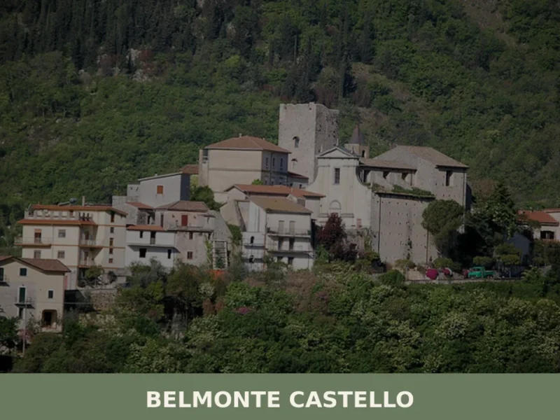
Belmonte Castello
A rocky hill above the Valle di Clia, Belmonte Castello is a small mountain settlement in Frosinone province where an old tower marks the skyline and the Apennine ridge begins just beyond.
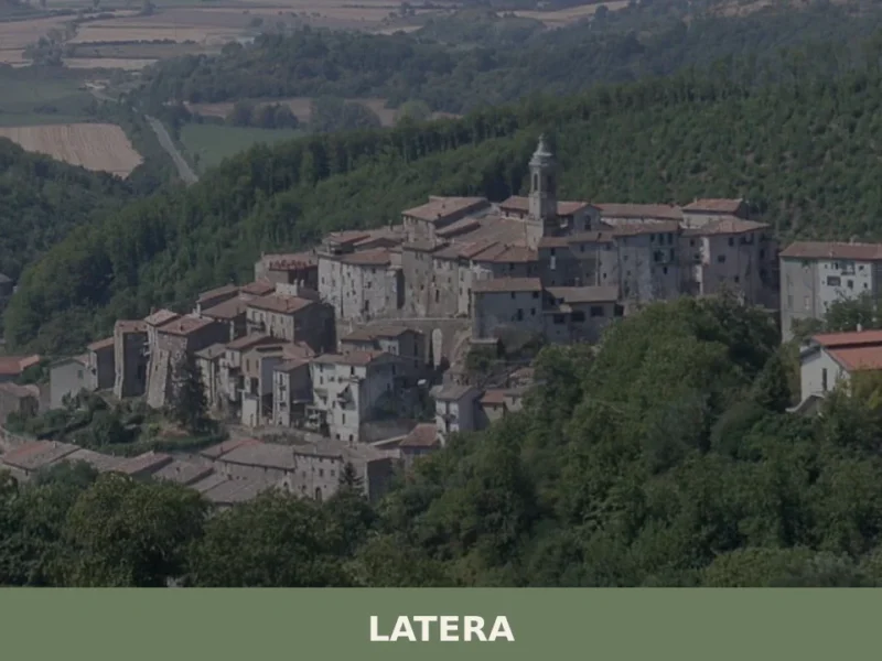
Latera
Latera has 766 inhabitants and sits on a tuff plateau at 508 metres above sea level, on the far northern edge of the province of Viterbo, close to the borders with Umbria and Tuscany. For centuries a fiefdom of the Farnese family, this small centre retains a compact Renaissance urban layout, with straight streets converging […]
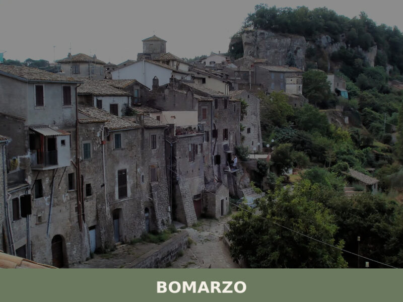
Bomarzo
Population 1,679. Visit for the Parco dei Mostri and the village's unadorned religious and domestic architecture rooted in the Cimini landscape.
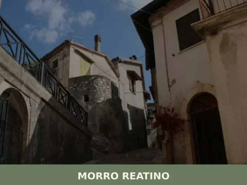
Morro Reatino
What to see in Morro Reatino: a village at 750 m in Rieti with 353 residents. Visit the medieval church of San Lorenzo, the historic centre, and discover PAT-certified guanciale amatriciano.

Terracina
44,000 residents, one ancient temple on a cliff, and centuries of Roman, medieval and papal history waiting along the Tyrrhenian coast.
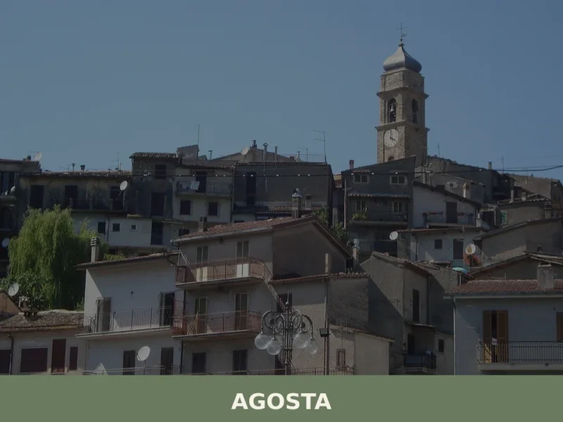
Agosta
Agosta is a historic municipality of 1,675 residents in the upper Aniene valley, Lazio, with continuous settlement from prehistoric times and a castle documented as early as 1051.
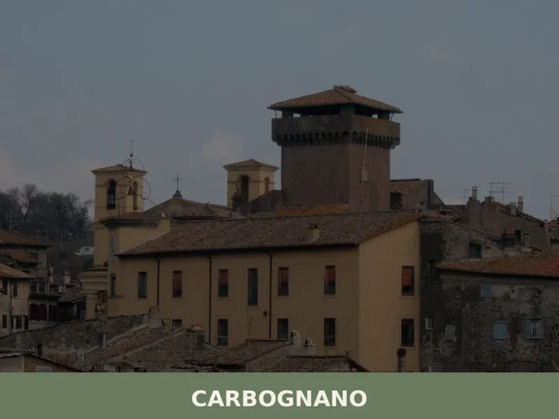
Carbognano
Carbognano is a hilltop comune of 1,973 inhabitants in the province of Viterbo, Lazio, set at about 379 metres above sea level in the Cimini hills.
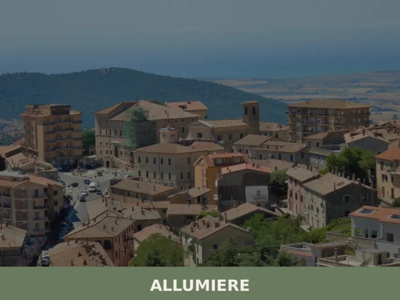
Allumiere
Allumiere is a hillside comune at 496 metres in the Monti della Tolfa, Lazio, shaped by centuries of papal alum production and home to a remarkable archaeological and mining museum.
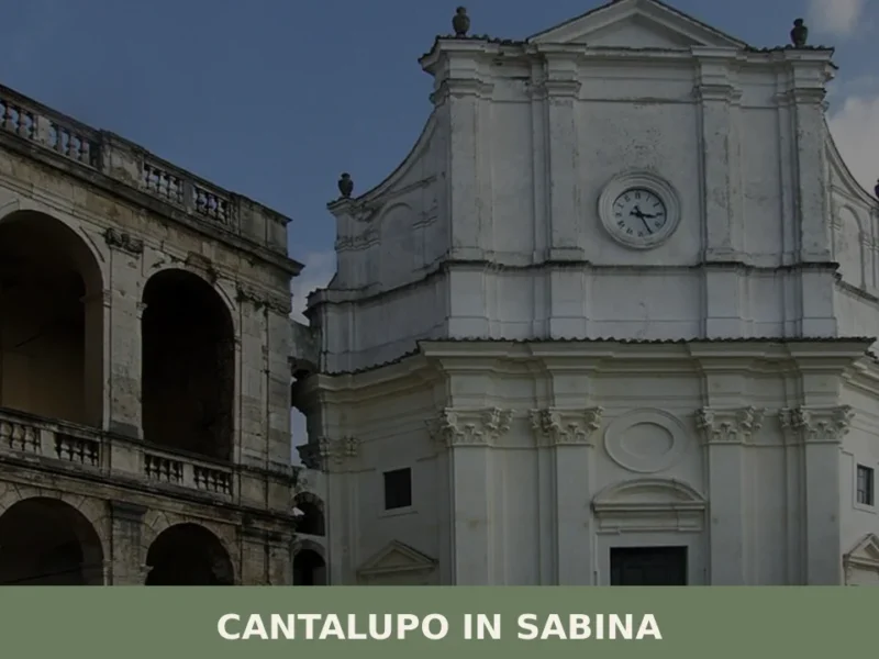
Cantalupo in Sabina
Cantalupo in Sabina is a medieval hill village in the Province of Rieti, Lazio, whose fortified origins date to at least 1037 and whose historic centre still reflects centuries of feudal heritage.
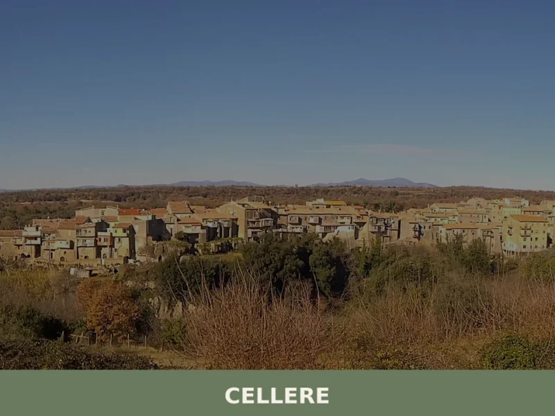
Cellere
what to see in cellere, Italy. Explore this Viterbo province village, 344 m high. Discover the Church of Sant'Egidio and local traditions. Read our guide!


🏡 Know Antrodoco better than we do?
If you’re a local or have been there, your knowledge matters: add what’s missing or fix a detail on this page.